

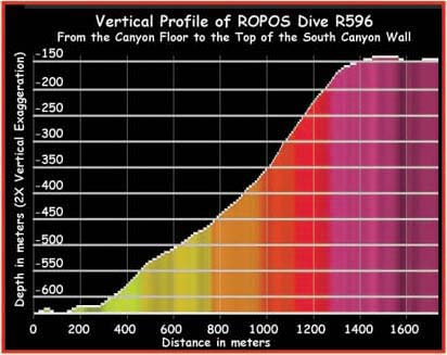
The first ROPOS dive at Astoria Canyon (R596) started at the canyon floor and made its way up the southern canyon wall. The image is a vertical profile of the dive track, based on data collected on the M/V Auriga a couple weeks prior to the cruise on the NOAA research vessel Ron Brown. Image courtesy of Lewis and Clark 2001, NOAA/OER.