

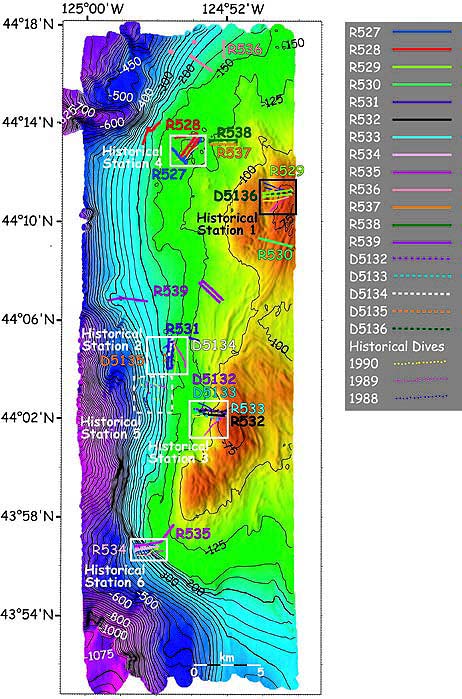
High resolution side-lit multibeam bathymetry (25 m contour intervals) of Heceta Bank from Simrad EM300 sonar. Lighting is from the northwest. Grid size is 10 m. Boxes show areas of historical dives from 1988 to 1990 (yellow, pink and blue dots) in Delta two-man submersible. Dives conducted in 2000 by ROPOS (R*) and Delta (D*) are represented by the solid and dashed lines respectively. Image courtesy of Lewis and Clark 2001, NOAA/OER.