

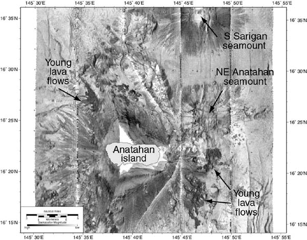
Map of MR1 sidescan sonar imagery around Anatahan island, collected during the 2003 Ring of Fire expedition. Dark areas on the submarine flanks of the island are young lava flows. Map by Paul Johnson, Hawaii Mapping Research Group.
Related Links
Submarine Ring of Fire 2003: Anatahan Log