

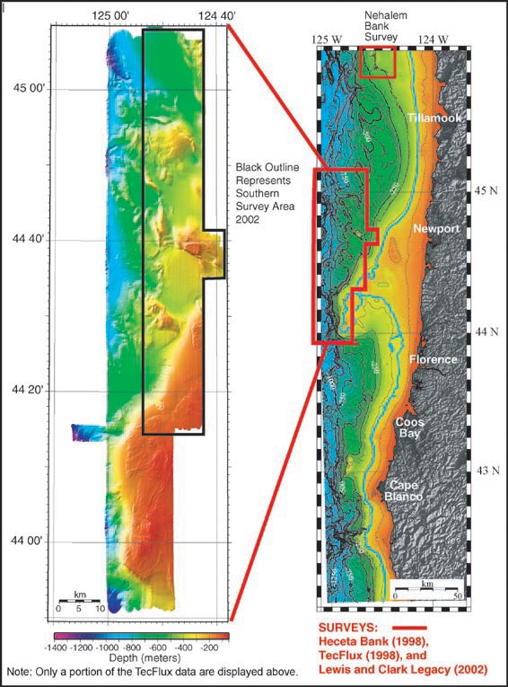
Figure to the right depicts the locations of the two survey areas for the Lewis and Clark Legacy, summer of 2002. The 140 meter blue contour (right image) depicts the lower limit of the 18 - 20 K eustatic sea level. Actual ancient shoreline may differ due to local tectonics. The figure to the left is a compilation of the EM300 data collected during 1998 and on the present survey (2002). The southern survey targeted an area flanked by existing high-resolution surveys to the west and south. The 2002 data are outlined in black. The second half of the present exploration will be conducted on Nehalem Bank, indicated by the red box in the upper portion of the right figure. Nehalem Bank historically has been an important fishing area for fishermen out of Astoria and Garibaldi, Oregon. During our current survey there are more than 2 dozen fishing boats operating just east of the bank. Image courtesy of Lewis And Clark Legacy Expedition, NOAA-OER.
Related Links