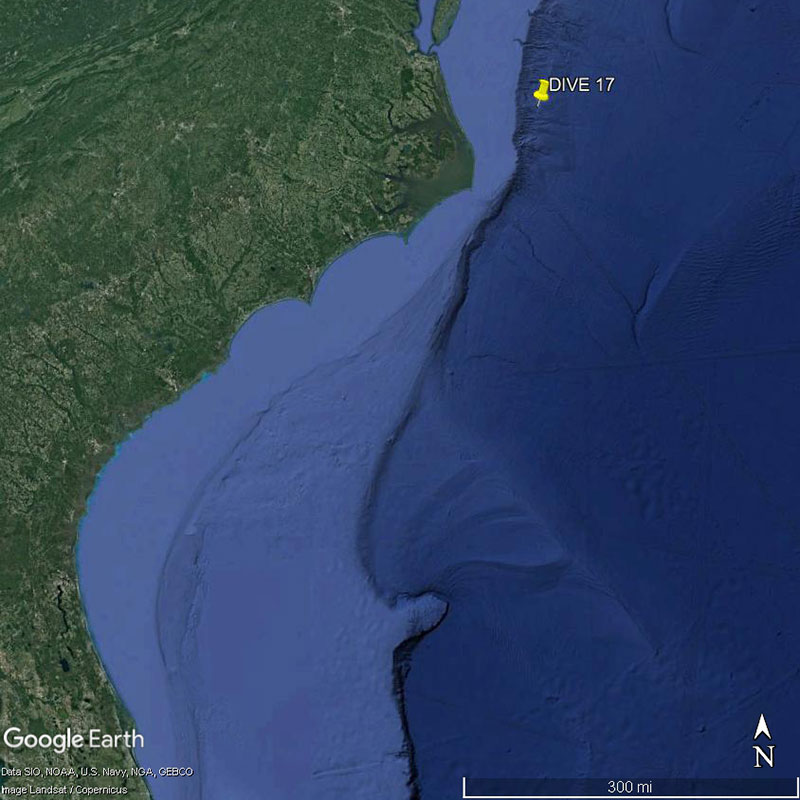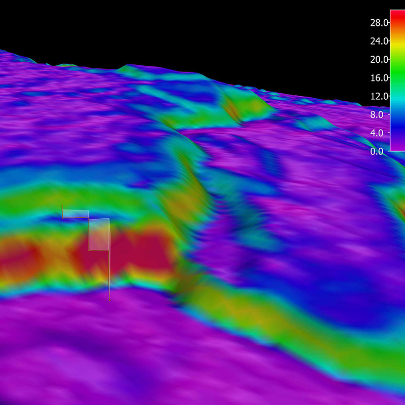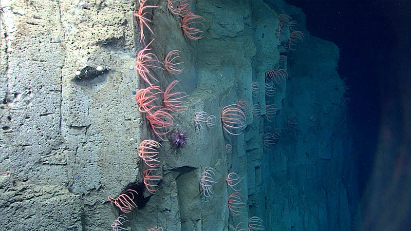
Brisingid sea stars imaged along the Currituck Landslide feature during the final dive, Dive 17, of the Windows to the Deep 2018 expedition. Image courtesy of the NOAA Office of Ocean Exploration and Research, Windows to the Deep 2018. Download larger version (jpg, 770 KB).
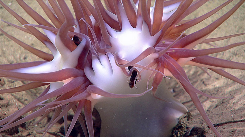
This unidentified anemone was seen for the first time during the Windows to the Deep 2018 expedition during the final dive, Dive 17, at around 1,878 meters (6,161 feet) depth. Image courtesy of the NOAA Office of Ocean Exploration and Research, Windows to the Deep 2018. Download larger version (jpg, 565 KB).
The Currituck Landslide is one of the largest submarine landslides along the U.S. east coast where a massive, partially intact, segment of the continental slope detached and slid to depths exceeding 2,000 meters (over 6,562 feet). A map of this and other landslides along the east coast can be found in this mission log. Data from this landslide site is often used in tsunami hazard modeling. Whether or not a submarine landslide will generate a tsunami depends on various characteristics of the landslide and you can learn more about those here. Today’s dive explored and characterized unfailed sedimentary sections preserved in the landslide’s lower headwall. This area was previously mapped by NOAA Ship Okeanos Explorer during the ACUMEN Campaign. Overnight mapping during this expedition added higher-resolution (50-meter resolution) data to this area, and the mission team saw that this new higher-resolution data matched the old data really well, indicating that there has not been much change in this feature in the past couple of years.
The remotely operated vehicle (ROV) Deep Discoverer was on the seafloor from 13:23:36 - 19:33:22 UTC. The ROV started at the bottom of the cliff feature at 1,862 meters (6,109 feet) depth and proceeded to scale the side of the staired feature until ending the dive at a depth of around 1,747 meters (about 5,732 feet). Along this dive track, the scientists observed gealogic fractures. At the start of the dive the ROV imaged many echinoderms including ophiroids, holothurians, and urchins, mostly pancake urchins. As the ROV moved up the steep slope, it imaged small rocks covered in a couple of different types of organisms, including corals, sponges, and brittle stars. Higher up, the slope was characterized by bigger blocks with corals, sponges, and aggregations of brisingid sea stars.
Other organisms seen throughout the dive were halosaurs, cusk eels, cup corals, octocorals, bamboo corals, sea stars, sea pens, anemones – including a new species not seen on previous dives, snycobrachid eels including one with a fish in its mouth, worms including the peanut worms, feather stars, comb jellies, pycnogonid (sea spiders), tripod fish, bathysaurous, shrimp, solitary hydroid, and multiple jelly-falls with urchins gathered around them. These jelly-falls, which are when gelatinous zooplankton sink to the seafloor, were probably lion's mane jellies. The scientists also saw benthic ctenophores on the acanella coral, a sample of which was collected for further analysis. The ROV also collected geologic samples of the sediment and a rock with many urchin associates. Learn more here about what happens to the samples once onboard NOAA Ship Okeanos Explorer. Also view the dive summary, once available, for more information on the samples collected and some of the species observed during the dive.
With the final dive of the Windows to the Deep 2018 expedition complete, NOAA Ship Okeanos Explorer heads back to port in Norfolk, Virginia, to prepare for the next expedition.
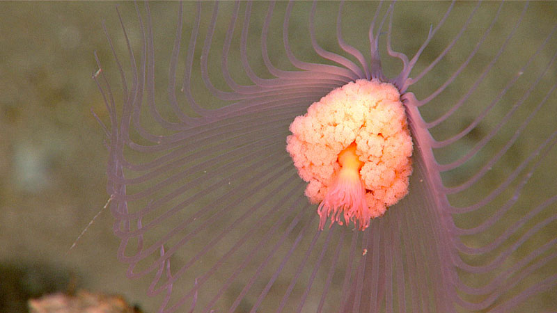
This potential colonial hydriod was seen during Dive 17 of the Windows to the Deep 2018 expedition. Image courtesy of the NOAA Office of Ocean Exploration and Research, Windows to the Deep 2018. Download larger version (jpg, 558 KB).
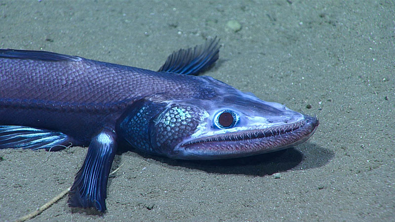
This deep-sea lizardfish, bathysaurus, was imaged around 1,771 meters (5,810 feet) depth during the final dive of the Windows to the Deep 2018 expedition. Image courtesy of the NOAA Office of Ocean Exploration and Research, Windows to the Deep 2018. Download larger version (jpg, 738 KB).
