

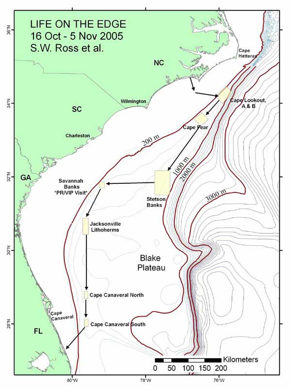
Map of the southeastern US study area, illustrating proposed path of the cruise and various deep coral sampling areas. Image courtesy of Ross et al, NOAA, HBOI.
Related Links
Life on the Edge 2005 - Mission Plan
Download high-resolution image (jpg, 1.7 Mb)