

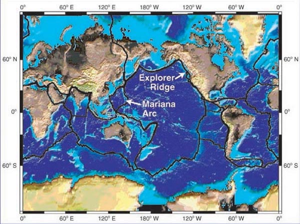
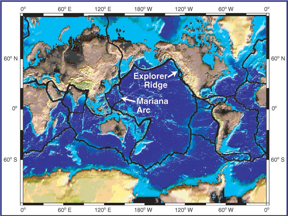
On this map of the Earth's surface, the plate boundaries are marked by a heavy black line. The boundary on the east side of the Pacific, running from Alaska to Mexico and then south through the Pacific ocean nearly to Antarctica, is a divergent boundary where the Pacific Ocean is being formed. The complicated boundary on the west side of the Pacific is primarily convergent, where the Pacific Ocean crust is subducted beneath more westerly plates and returns to melt within the mantle. The Ocean Exploration project “Exploring the Submarine Ring of Fire” will investigate hydrothermal sites on both boundaries. Image courtesy of Submarine Ring of Fire 2002, NOAA/OER.