

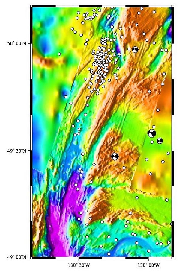
Map view of the bathymetry and earthquakes (white dots) located along the Explorer Ridge and the surrounding region. Yellow-shaded bathymetry shows seafloor less than 1000m deep, green 1000-2000m deep, blue greater than 2000m. The earthquakes shown in this map occurred between August 1991 and January 2001 and were located using the U.S. Navy's SOSUS hydrophones. Image courtesy of Submarine Ring of Fire 2002, NOAA/OER.