

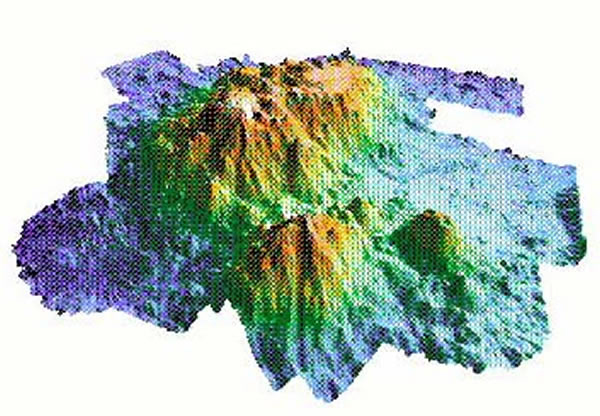
This 3-dimensional rendition of a bathymetric map shows Patton Seamount (looking north), a Gulf of Alaska seamount we visited in 1999, and two smaller seamounts in the foreground. Deep areas are blue and shallow areas are red. Patton Seamount is about 10,000 feet tall and 20 miles wide. We will be making similar maps on this expedition. Image courtesy of Exploring Alaska's Seamounts 2002, NOAA/OER.