
Ocean Exploration 2020: Photo Contest Winners
We asked you to help us get inspired about ocean exploration by celebrating the beauty and wonder of the ocean in pictures by submitting your best ocean photos for a chance to win the Ocean Exploration 2020 Photo Contest. We are proud to announce the winners from each category:
About the Judge: Michael T. Jones, Chief Technology Advocate, Google, Inc., selected the contest winners based on originality, artistic composition, technical quality, photographic technique, and whether the photograph showcases the value and wonder of our ocean. Michael is an accomplished amateur photographer who built his own four-gigapixel camera using U2/SR71 components.
Explorers: Exploring a Coral Wall
Michael Eversmier, Cockeysville, Maryland
Photo of a diver exploring a healthy coral wall off the coast of Eleuthera in the Bahama Islands.
Judge's Comments: This image of coral and diver expresses the beauty and wonder of the sea, the enormity of what we do not yet know about life in the sea, and the way that technology gives human explorers the freedom to experience and learn, which is a perfect match to the photo's location of Eleuthera, which is Greek for 'freedom.'

View high-resolution image (jpg, 6.6 Mb)
View all the finalists in the Explorers category.
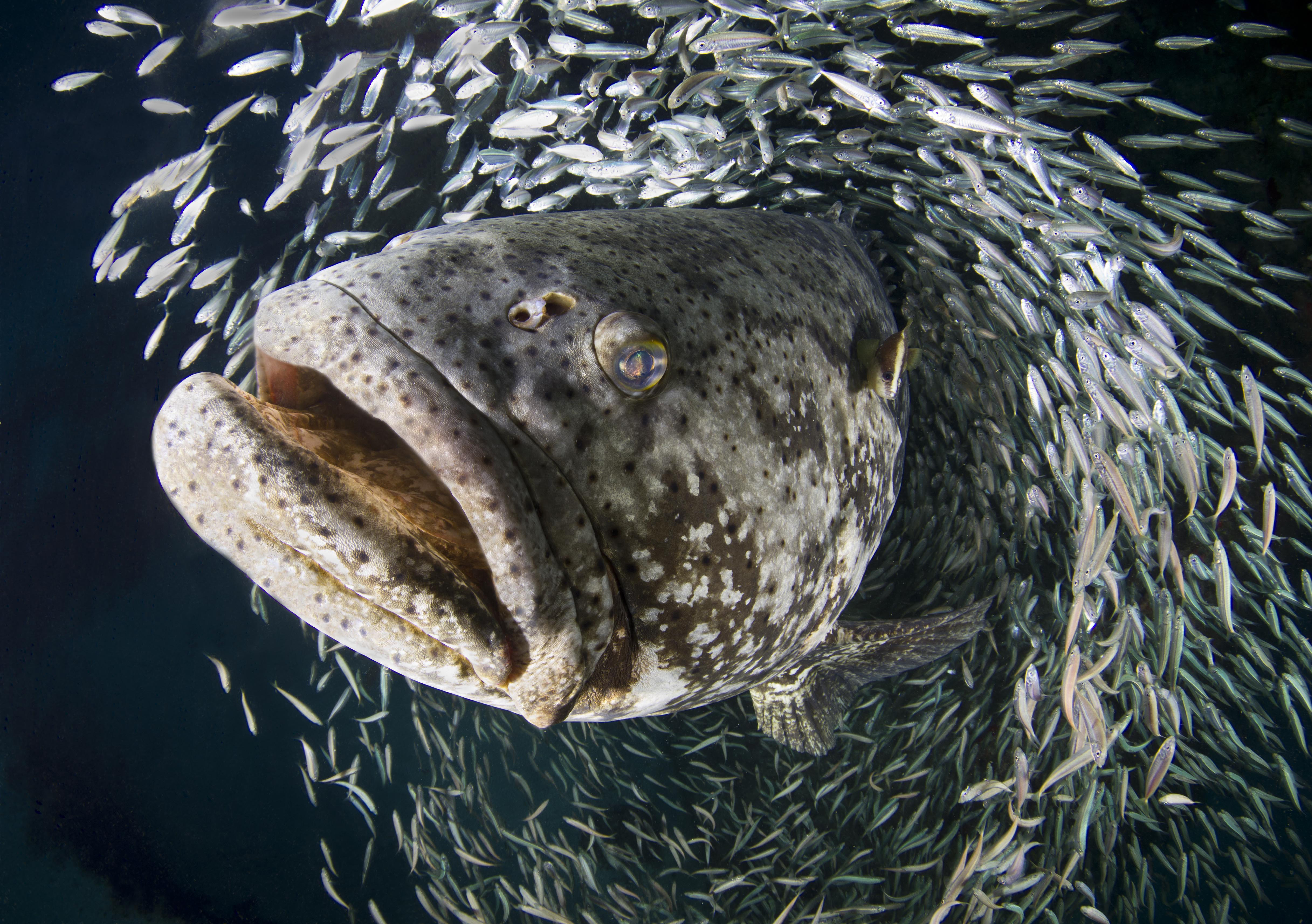
Marine Life: Goliath Grouper
Laura Rock, Miami, Florida
This photo was taken on September 19, 2012, in Jupiter, Florida. Annually, Jupiter is known for the large spawning aggregations of goliath grouper. Pictured here is a goliath grouper piercing through a school of baitfish.
Judge's Comments: Striking in composition, exposure, and timing, this marvelous image tells a double story of marine life; first, that it exists in wondrous diversity of scale and shape, and second, that the oceans are in many ways a Peaceable Kingdom of comfortably coexisting marine life.

View high-resolution image (jpg, 6.7 Mb)
View all the finalists in the Marine Life category.
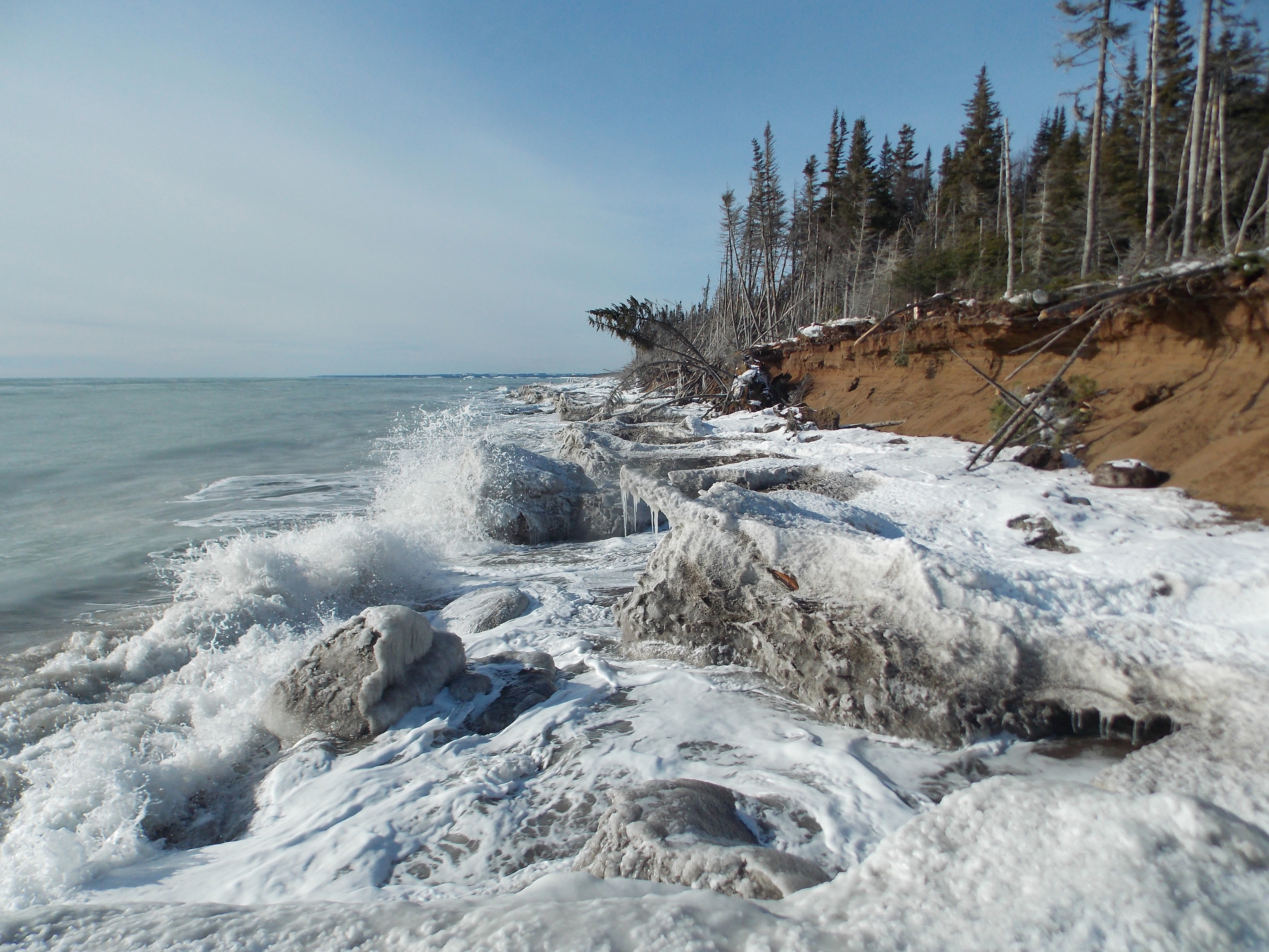
Scenic Seascapes: Icefoot
Stefanie Van-Wierts, Rimouski, Quebec, Canada
This photo was taken on February 2013 at Longue-Pointe-de-Mingan, on the north coast of the Gulf of St.Lawrence, Quebec, Canada. It show how the icefoot protects the sandy cliff face to the force of the waves during the winter season.
Judge's Comments: Shorelines are the shared border between land and sea, defining the extent of each. This image shows the border in dynamic tension between forces of wind, wave, rain, snow, ice, and vegetation. We see winter snow and ice forming a protective barrier against the winter sea, yet trees in the distance show erosion's relentless summertime advance.

View high-resolution image (jpg, 7.6 Mb)
View all the finalists in the Scenic Seascapes category.
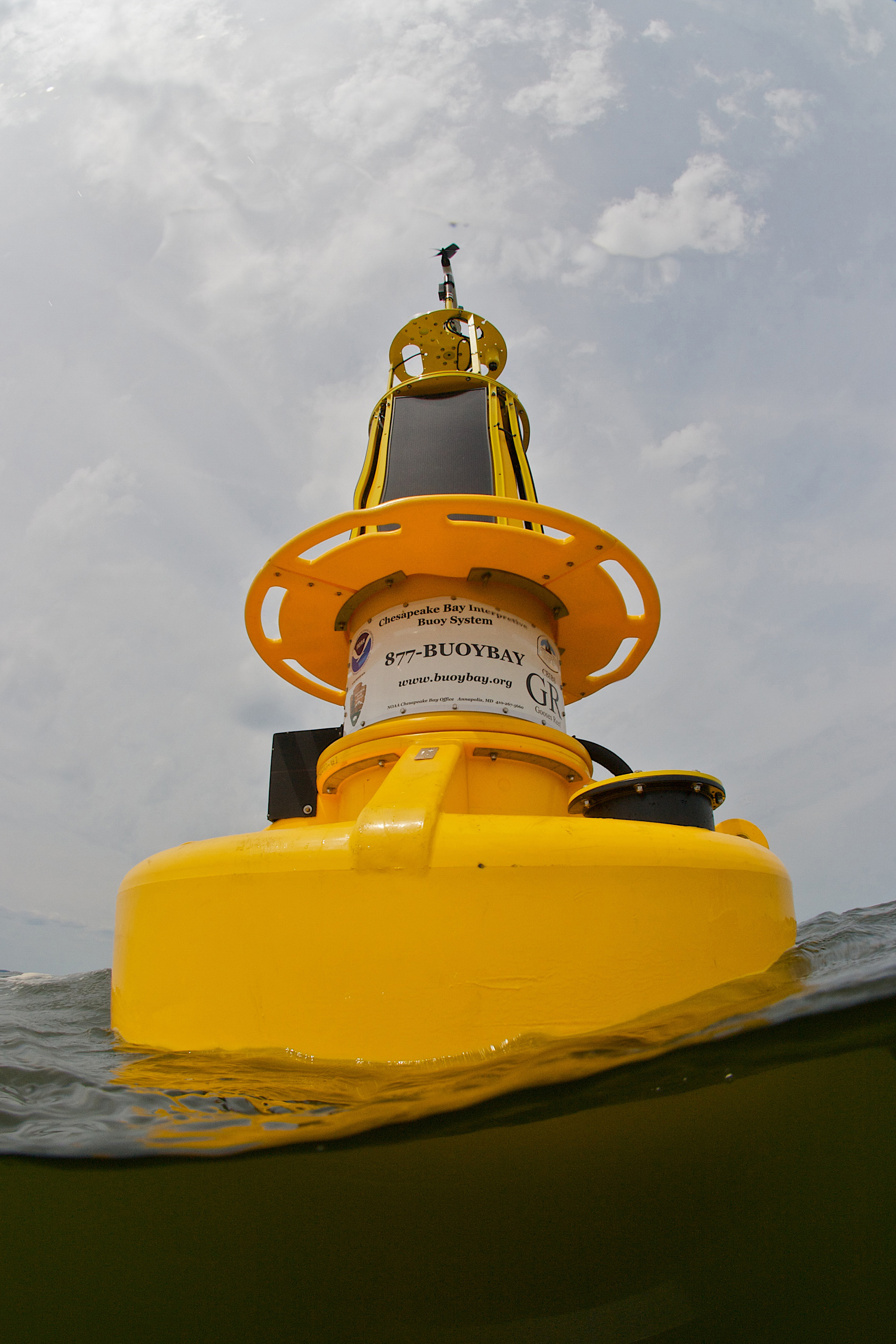
Navigation and Techonlogy: Buoy
Michael Eversmier, Cockeysville, Maryland
This buoy was photographed for the Maryland Artificial Reef Initiative the day the buoy was deployed. Many people in the Chesapeake Bay area use the data that the buoy collects. The buoy data are very useful to me when planning dives on the artificial reef that it is near.
Judge's Comments: Marine navigation has always been a voyage of understanding built from adventure, data gathering and data interpretation. This was true with 13th century portolani (the world's first Wikipedia) and remains true today with the technologies that NOAA and others use to observe, record, gather, and analyze the ocean and its inhabitants.

View high-resolution image (jpg, 4.7 Mb)
View all the finalists from the Navigation and Technology category.