

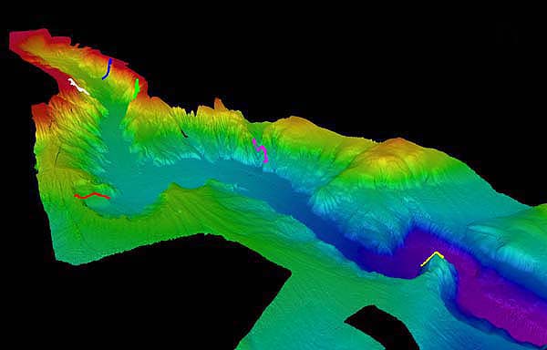
Three-dimensional image Astoria Canyon looking southeast. The head of the canyon is to the left. ROPOS dive tracks are superimposed: blue, June 28; fuschia, June 29; green, June 30; white, July 1; red and black, July 2; and yellow, July 3. Relief is 400 - 500 meters from the top of the wall to the canyon bottom. The entire canyon is aproximately 120 km long "as the crow flies" and has an aproximate area of 1000 square km (using 8km as the average width). Image courtesy of Lewis and Clark 2001, NOAA/OER.
Related Links
Lewis and Clark Legacy: July 3 scientific discipline summaries log