

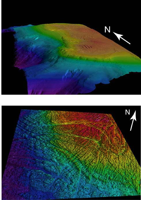
3-D maps of Heceta Bank made from multibeam sonar data collected in 1998. The top image is an area about 30 miles north to south and about 10 miles east to west. The southern part of the bank has a clearly defined western edge marking an ancient shoreline. Note the sediment slide scar on the southern slope of the bank. The bottom image is the northern shoal portion of bank in sidelit bathymetry looking north-northeast in the middle portion of the bank showing details of outcropping geology . Lighting is
from right (east). The fracture patterns are "megajoints" caused by internal stresses in the earth. The curvilinear troughs in the northeast section of the view are caused by variable rates of erosion of
outcropping rocks. Image courtesy of Lewis and Clark 2001, NOAA/OER.