back banner
back button
spacer
ocean explorer home pageNOAA home page

Savannah Scarp Dive sites


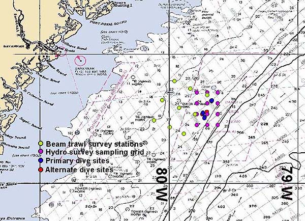
This map shows planned dive sites, hydro survey sampling areas, and planned locations for beam trawl survey stations at Savannah Scarp. The first dive occured in an area known as the 'sandwich.'


Related Links

Islands in the Stream: September 7 Log

Maps Gallery


E-mail Updates | User Survey | Report Error On This Page | Site Index | Contact Us
Revised July 12, 2005 by the Ocean Explorer Webmaster
National Oceanic and Atmospheric Administration | U.S. Department of Commerce
NOAA Logo Commerce Logo
http://oceanexplorer.noaa.gov/explorations/islands01/log/sep7/media/scarp_divesites.html