
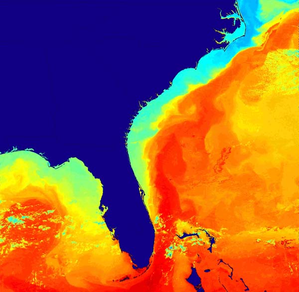
Sea surface temperature as derived from satellite imagery. The deflection of the Gulf Stream to the east at the Charleston Bump is apparent. Image courtesy of Islands in the Stream 2001, NOAA/OER.
Related Links
Islands in the Stream: Islands

Sea surface temperature as derived from satellite imagery. The deflection of the Gulf Stream to the east at the Charleston Bump is apparent. Image courtesy of Islands in the Stream 2001, NOAA/OER.
Islands in the Stream: Islands