By John C. Bright - Research Coordinator, Thunder Bay National Marine Sanctuary
April - July 2017

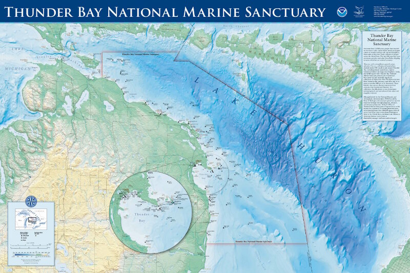
Map of the boundaries of Thunder Bay National Marine Sanctuary, showing documented shipwreck sites and a view of Lake Huron and the coast. Image courtesy of Thunder Bay National Marine Sanctuary, NOAA. Download larger version (jpg, 1.2 MB).
Following the expansion of Thunder Bay National Marine Sanctuary in 2014, one of the prime research goals has been surveying newly included sanctuary areas for undiscovered shipwrecks. While 93 individual historical shipwrecks are already known throughout this area, archival research indicates that as many as 100 more wrecks are yet to be found. Searching, however, is not easy task. This spring and summer, researchers will conduct a four-part expedition to test new tools for finding wrecks.

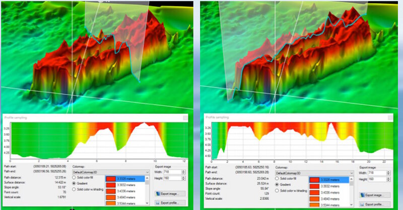
Rendered 3D bathymetric data products from an acoustic scan of a 19th century wooden barge. Image courtesy of Guy Meadows/Michigan Technological University. Download larger version (jpg, 137 KB).
Numerous environments exist throughout the sanctuary, ranging from shallow coastal areas to very deep stretches in the middle of Lake Huron. Throughout these environments, researchers employ an array of techniques and tools to remotely scan the lake floor. The resulting optical and acoustic imagery supplies data to an array of academics fields, including archaeologists looking for shipwrecks, biologists examining underwater habitats, and geologists studying the composition of the lake’s bottom.
Increasingly, technologies are becoming more powerful, portable, and providing detailed data products. Yet, no single tool is a one-size-fits all solution. Researchers must weigh an array of different variables and select the methods and tools most appropriate for their specific needs.
Innovative approaches, therefore, are of great value to the scientific community by finding new ways to use these surveying tools or testing of new or modified systems. To assist with the search for undiscovered shipwrecks in the Thunder Bay National Marine Sanctuary, a collaborative, interdisciplinary research team is going to test new ways to find shipwrecks in shallow water areas, as well as some of the deepest offshore areas of Lake Huron.

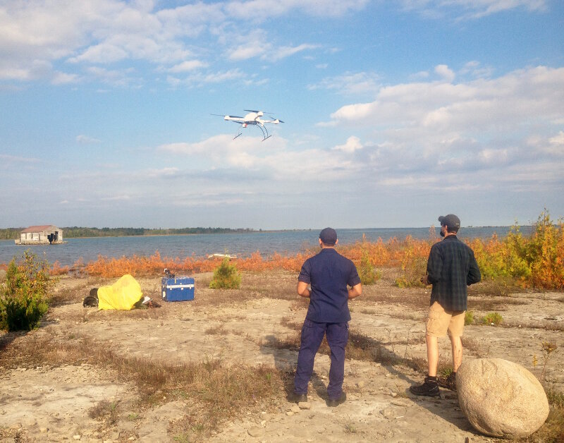
An UAS takes off from Thunder Bay Island under the supervision of its pilots. Image courtesy of Thunder Bay National Marine Sanctuary, NOAA. Download larger version (jpg, 2.7 MB).
Over the course of a four-part expedition throughout the spring and summer of 2017, Thunder Bay National Marine Sanctuary will host a multifaceted, ongoing research project.
First, from April 10-21, the team will test new approaches for integrating Unmanned Aircraft Systems (UAS) as a marine archaeological survey tool. Here, camera-equipped UAS systems will operate over the water and image the shallow lake floor, made possible by the exceptional water clarity of Lake Huron during early spring months.

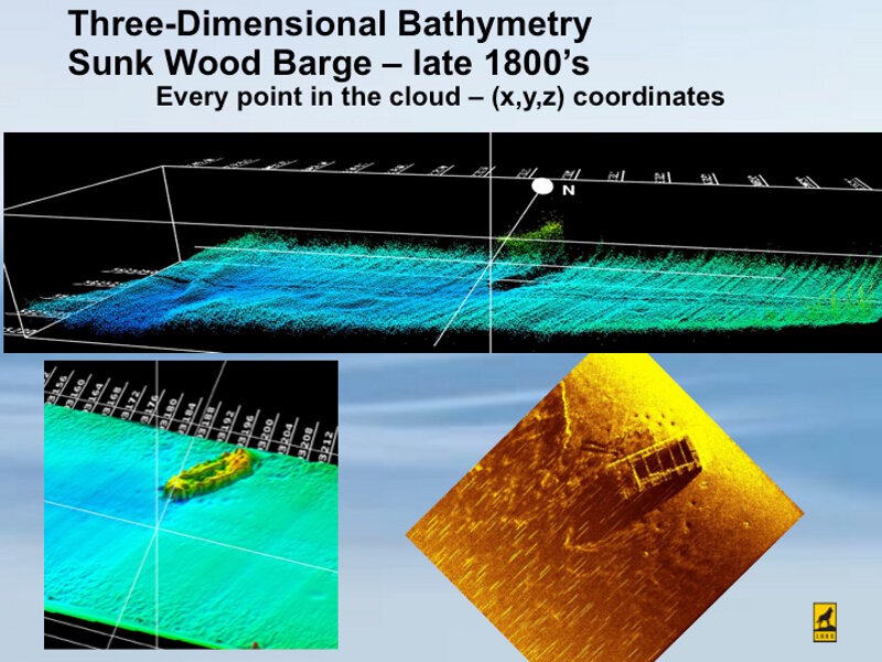
Isometric view of a 3D point cloud data generated by acoustic scans over an historic sunken barge. Inset also includes a side scan sonar view. Image courtesy of Guy Meadows/Michigan Technological University. Download larger version (jpg, 177 KB).
Next, from May 15-26, the team will transition into another exploratory survey, this time in the deep, unexplored waters within the northern extents of the new sanctuary boundary. With a wide sweeping sonar device, this phase of the project endeavors to image as much of lake floor as possible in a 10-day period.
The team will operate continuously, 24 hours per day. The results of this survey will be numerous ‘targets,’ or non-natural items discovered along the lake’s bottom.
As a follow up to the deep acoustic survey, between June 19-30, researchers will deploy autonomous underwater vehicles (AUVs) to collect detailed, high-resolution imagery of all the targets. Such imagery will assist archaeologists in determining if newly discovered items are shipwrecks, and if so, important details about their size, shape, and integrity on the lake bottom.
The final stage of the project, taking place July 10-21, will involve scuba diving to put scientists in the water to directly observe these shipwrecks and collect high-resolution photographic and video imagery. Photogrammetric models—a emergent data processing tool that turns individual images into 2D and 3D models—will be developed from the diver-collected imagery.
By executing these research phases sequentially, the team will dramatically reduce the amount of time between discovering an historical shipwreck site and developing completed, detailed baseline archaeological understanding of its remains. Likewise, the shallow water survey completed with UAS technologies will provide valuable insights into their broader application as a valuable marine survey tool.
Check back after each phase of work and find out what these innovative technologies revealed from beneath Lake Huron’s waves.