By Bradley W. Barr, Ph.D., NOAA Office of National Marine Sanctuaries Maritime Heritage Program, Co-Principal Investigator and Chief Scientist & Randolph G. Beebe
We are not the first expedition to search for these whaling shipwrecks from 1871. In 1998, The Jeremy Project , a collaboration involving NASA, the U.S. Coast Guard, and Santa Clara University, among others, visited this part of the Chukchi Sea coast with a remotely operated vehicle (ROV) and found “positive evidence of a sunken ship near the last known location of the whaling fleet.” While we could not find more detailed information regarding their reported 1998 discovery, we continue to search for this documentation.

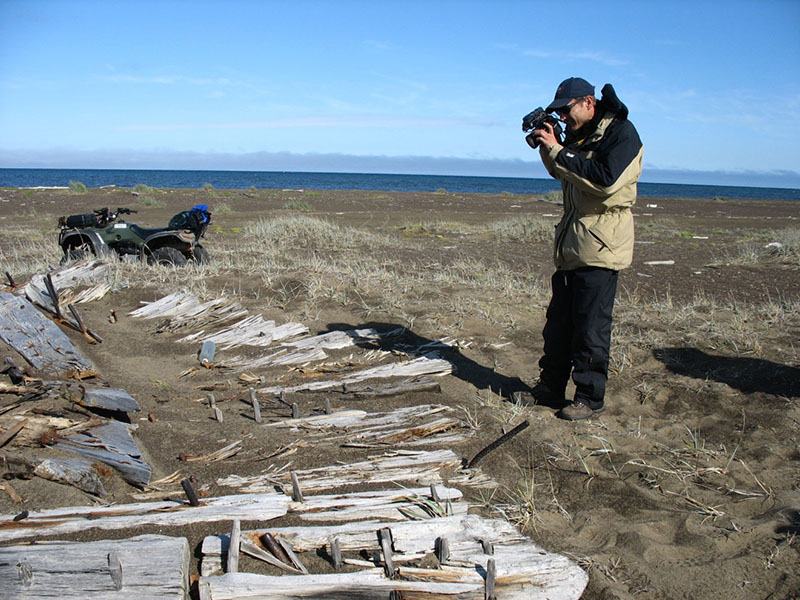
Randolph Beebe documenting a large bow section of a wooden whaling vessel found along the shoreline. Image courtesy of Pete McConnell. Download larger version (jpg, 878 KB).
In 2005, another team of researchers embarked on a multi-year effort to find the remains of Alaska’s lost whaling fleets. Their work, described below, was used extensively to guide and inform the offshore surveys we plan to conduct in the nearshore waters of the Chukchi Sea off Wainwright this August. Their research project offered considerable insight into what could be expected when the current mission arrives in the area to continue and expand on their important first steps to illuminate the events of 1871, when 32 whaling ships were trapped in the ice and abandoned. Two particular pieces of information were found to be most useful. First, the locations of the wreckage on the beach, so thoroughly documented by this team, was extraordinarily helpful in establishing some clearer sense of the ultimate fate of many of these wrecks. Mapping the location of the pieces of vessels that had broken apart, subjected to the forces of wind, wave and ice identified patterns of debris consistent with the available historic documentation of the events of September, 1871. This suggests that the remains of the vessels were broadly distributed along the shoreline, and that many pieces of these ships still remain in the area and have not been transported elsewhere over the years. Second, the lack of findings of debris clearly related to the abandonments of 1871 in the nearshore waters by this extensive multi-year search is also very valuable information. In these sorts of archaeological surveys, as is true more generally of all research, not finding something is often as important an outcome as actually finding something. As mentioned in the essay below, this stretch of coast is subject to significant shoreline erosion, in some places estimated to be perhaps 20 feet of shoreline retreat per year.
On a recent visit to Wainwright, I noted that a very large stone revetment had been constructed in the last few years to protect the village from rapid erosion, and heard stories from Iñupiat elders recollecting that, within their lifetimes, houses originally built along the bluff had been moved to higher ground three and four times. What this suggests is that, as a result of the rapidly changing climate in the Arctic, what we see today as the shoreline is not what was present in the 1870’s, and that we would need to adjust our survey plans to try and capture the area where the vessels actually were abandoned, which is now farther offshore. It was very evident, flying into Wainwright from Barrow on this recent visit, that the shoreline depicted on the chart that serves as the baseline for our survey has changed quite significantly over the years since that chart was last updated. Given these insights, our identification of the area to be surveyed during this mapping mission was adjusted to areas lying a somewhat greater distance offshore. There is little site-specific data on where the 1871 shoreline might have been, but some additional research on what is known about the rate of shoreline retreat in this general area has been employed to estimate where that historic shoreline may have been, and therefore how far offshore we should be focusing our mapping efforts. Very rarely does science progress by “eureka moments”, but incrementally advances building on the work of others. We are indebted to Randy Beebe and his team for sharing their findings with us, and helping us to better understand the task at hand as we planned our approach and methodology for these latest surveys of this extremely important historical landscape.
Nature handed man one of his greatest defeats in his longtime battles with the Arctic Ice in the fall of 1871 when thirty-two Yankee whaling ships became trapped in the ice near Wainwright Alaska. This event, which resulted in the loss of almost all of the ships and the dramatic escape of the crews, became known as the Great Whaling Disaster of 1871.
From 2005 to 2008 a marine archeological expedition traveled to Northern Alaska with support from the National Geographic Society, the National Science Foundation, and the Barrow Arctic Science Consortium to conduct a site-survey and determine what remained of these wooden sailing ships. The project’s overall intent was to make a research contribution to Alaska maritime archaeology and ship anthropology by locating and documenting shipwrecks from this historic whaling ship disaster.

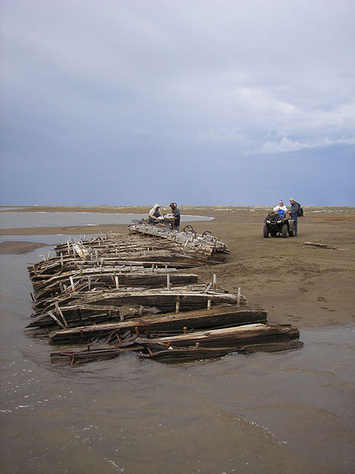
The project team used ATVs to search the shoreline for wreckage and debris from the whaling shipwrecks. Image courtesy of Randolph Beebe. Download larger version (jpg, 1.9 MB).
Our task on this four-year project was to survey coastal areas using various underwater and terrestrial search techniques to locate and document any wrecks or artifacts associated with the disaster. The search area was extensive. When the whaling fleet was abandoned, the ships were spread along the coast from Miktalavik (south of Wainwright) north to Point Franklin, a distance of over ninety miles. Over three seasons our group spent 30 days in the field and of those only 11 days afforded weather that allowed remote sensing surveys using an inflatable Zodiac boat and underwater survey work using scuba. The remainder of the time was spent onshore conducting a detailed terrestrial survey of the coastline from Wainwright to Point Franklin photographing and documenting beached shipwrecks and ship artifacts. We camped on the shore of the Chukchi Sea near Point Belcher (north of Wainwright) and used four-wheel ATVs to travel the beach. In addition, we used aircraft to rapidly survey the shore and shallow coastal waters along the coast Aerial surveys were conducted in 2007 using a high-wing Sky Arrow aircraft operated by San Diego State University involved in climate research in the region and again in 2008 using a B-105 helicopter.
Underwater survey methods evolved over time as we learned more about the wrecks and the natural processes operating along the coast. We started by using side-scan sonar and a drop video camera to locate submerged wreck sites. Over 20 square miles of sea floor was searched using this method. This area represented approximately 10 percent of the total potential search area and was selected because research showed it had the highest probability for shipwrecks. Later a boat-towed magnetometer was incorporated into the survey to locate buried shipwreck sites.
Over 200 anomalies were detected by remote sensing but when a sampling of the more promising targets were ground-truthed, we discovered them all to be of natural origin. However, time constraints did not allow us to examine all of the anomalies we located.
The north coast of Alaska frequently experiences violent and long-lasting storms that redistribute enormous amounts of sand and gravel, changing the water depths and altering the coastline with erosion rates as high as 20-feet per year. Even more problematic is ice behavior: in a typical year pack ice scours the sea floor to at least 80 feet as documented in our side-scan sonar data. The potential impact of storm activity and ice movement on shipwrecks are significant, and these two factors alone would likely fragment and bury wrecks.
The results from surveys of the terrestrial coastline were completely different. During aerial and on-the-ground surveys of the coast a wealth of shipwreck items were found and documented including a wide array of hull fragments and iron artifacts in a remarkably good state of preservation due to arctic conditions. Several individual wreck sites were recorded--evidenced by large hull sections driven ashore by the ice and storms. Hundreds of smaller finds were associated with the hull sections as well as numerous isolated finds between the sites. Examples of these items include all manner of structural timbers, a rudder, rigging hardware, a pawl post, copper sheathing, leather chafing gear, and numerous fragmentary items made of wood.

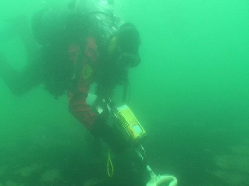
Randolph Beebe using an underwater metal detector to search for metallic artifacts in the vicinity of the socalled “Chainplate Wreck.” Image courtesy of Pete McConnell. Download larger version (jpg, 265 KB).
In 2008, the "Chainplate Wreck" site, named for this prominent visible feature, was singled out for a more detailed, representative survey both on and offshore using side-scan sonar and scuba. The waters offshore were double covered at high resolution with the side scan and all anomalies were visually inspected. Divers conducted the visual inspections and used an underwater hand-held metal detector to determine if any additional portions of the wreck or artifacts lay offshore in the surf zone. The artifacts exposed onshore were also mapped more precisely to establish provenance and to better understand the processes of site formation.
The task of assigning specific ship names to any of these individual wreck(s)/sites is problematic because no name boards, bells, or other unique features that can positively identify a specific ship were found. This problem is compounded because all 31 whaling ships shared similar construction features and dimensions. Nevertheless, inferences concerning ship identities can be drawn. For instance, the Chainplate Wreck shows signs of having been burned, and the historic record indicates that several ships such as the Concordia had been set on fire by Inupiat at the time of the disaster.

The bark Concordia, one of the ships in the 1871 fleet destined to fall victim to the Arctic’s treacherous seaice, hailed from New Bedford, Massachusetts. Image courtesy of the New Bedford Whaling Museum. Download (jpg, 48 KB).
In addition to the shipwrecks themselves, six abandoned prehistoric and post-contact Inupiat village sites near the coast have been surveyed and excavated in the past by archaeologists. Five of these village sites clearly show the utilization of ship timbers and iron fasteners in the construction of subterranean homes and cellars. Many smaller items such as parrels, barrel hoops, chain and whaling irons are associated with these sites, indicating salvage from the whaling ships. Archaeological excavations at the village of Pingusugruk, an important site near Point Franklin recovered numerous examples of shipwreck materials. A more detailed study linking these village sites to the 1871 Shipwreck Disaster would afford a fascinating window into village life in the late nineteenth century and the impact that enormous amounts of shipwreck material had on local Native people.
Toward the end of the project, we learned that over the years many maritime artifacts from the whaling wrecks had been salvaged from the beach by Wainwright villagers and were in local collections. Many people invited us into their homes to show us salvaged items and share photos of whaling irons, flensing tools, clocks, and other items that they or their ancestors had collected in the past. An effort to document these items and to research any more that might exist in the community would certainly be an interesting continuation in the study of this historic event in American history.

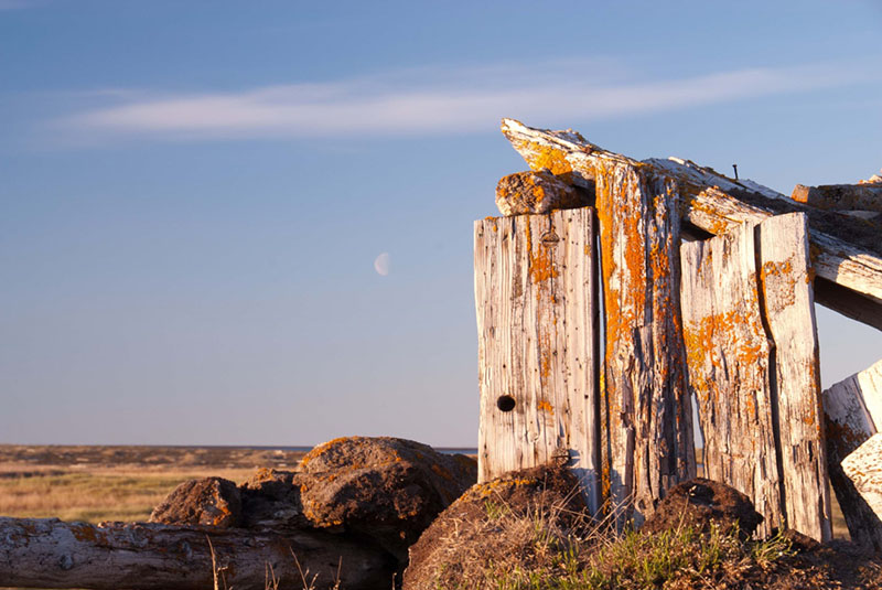
Large trees do not grow on the Arctic tundra so wood is a scarce, much soughtafter, commodity. This structure, in the abandoned village of Atanik, was likely built to serve as a cache. It’s possible that some or all of the wood used in the structure was recovered from a ship, possibly a vessel from the 1871 fleet. Image courtesy of Randolph Beebe. Download larger version (jpg, 648 KB).