By J.M. Adovasio, Expedition Principal Investigator - Mercyhurst University
and C. Andrew Hemmings, Expedition Principal Investigator - Mercyhurst University

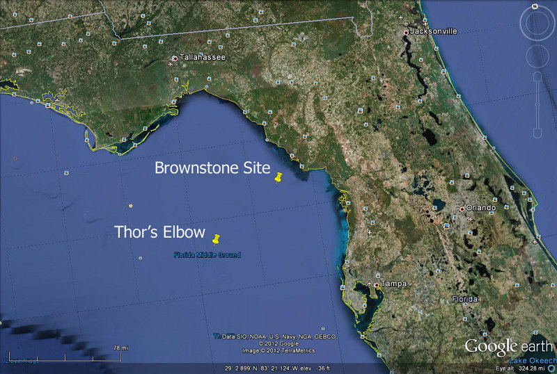
Basic locations of the two planned excavation sites, Brownstone and Thor's Elbow, plotted in Google Maps. Image courtesy of Exploring the Submerged New World 2012 Expedition, NOAA-OER. Download larger version (jpg, 600 KB).
This year’s Submerged New World project is centered on further exploring and sampling two previously identified sites off Florida’s Gulf Coast. The first site, called the Brownstone site, is located in 40 feet of water 95 miles northwest of Tampa; and the second site, called Thor’s Elbow, is located in 130ft of water 125 miles west/northwest of Tampa. The Brownstone site has bedrock exposed on the seafloor that forms one side of the buried, but intact, river channel. The bedrock at this site is low grade knappable toolstone (either chert or dolostone) that could have been used for tool making prehistorically. The deeper site, Thor’s Elbow, is the intersection of the ancient Suwannee and another river where we expect to find more knappable bedrock buried under the modern seafloor surface.
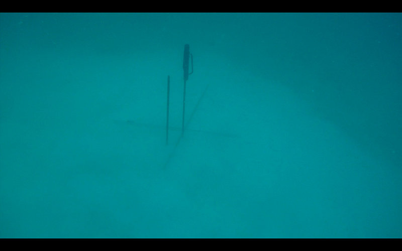
Our divers have visited Thor’s Elbow and Brownstone and taken sediment core samples and/or bedrock stone samples in 2009, 2011, and earlier in 2012. At each site we have installed metal poles to anchor our dredge hose and floating screen deck to sieve the sediments from the bottom of the seafloor. Collected sediment can be examined on the floating screen by scientists at the surface. We will be working in shifts, and the need for visibility on the seafloor limits our excavation to daylight hours.

Crossroads at Thor's Elbow, where metal poles have been installed. These poles act as a marker for divers, as well as providing an anchor for the dredging equipment floating above. Image courtesy of Exploring the Submerged New World 2012 Expedition, NOAA-OER. Download larger version (jpg, 1.1 MB).
In essence, the objective of this year’s work is to ground-truth our electronic data of these sites with hands on collection of ancient sediments. These should be progressively shallow water marine or brackish water materials overlaying older freshwater riverine sediments. Below the aquatic sediment package we expect to recover buried terrestrial sediments from the late Pleistocene when this area was still dry land adjacent to the Pleistocene Suwannee River.
At each of these sites we hope to locate prehistoric human made artifacts, bones of Pleistocene animals, such as the mastodon or mammoth, and perhaps datable organic material such as pieces of wood. Any such finds would indicate that the now inundated Pleistocene landscape of Florida in the Gulf of Mexico is still preserved, accessible to archaeologists, and contains prehistoric evidence of the use of this landscape by people and animals alive at the end of the last Ice Age.