


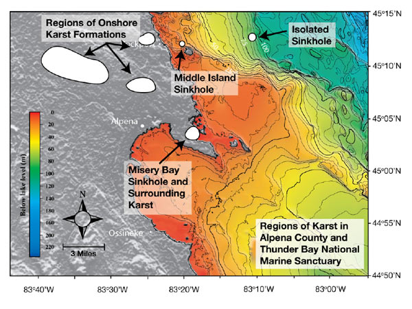
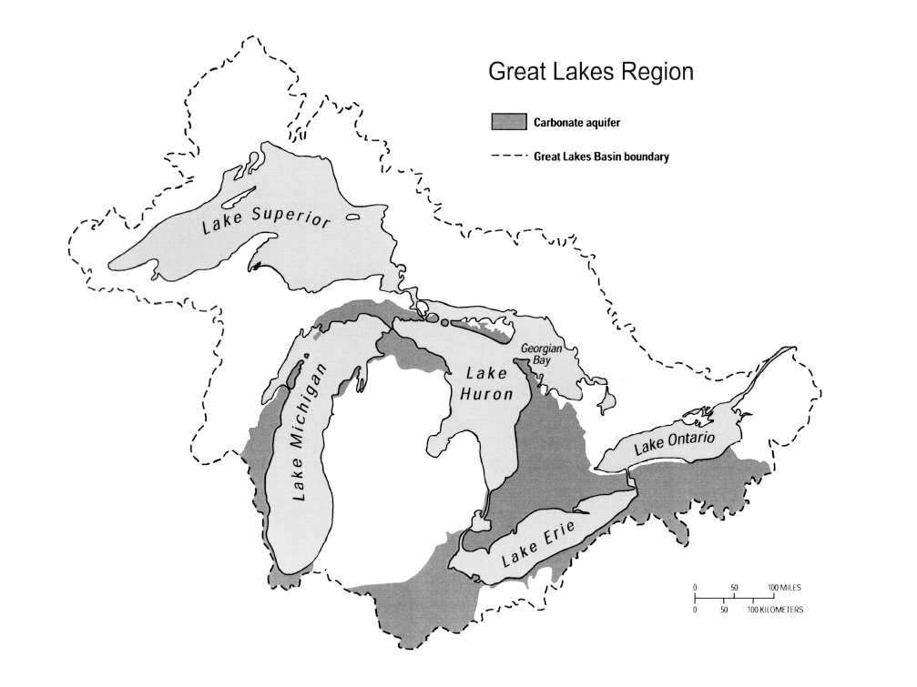
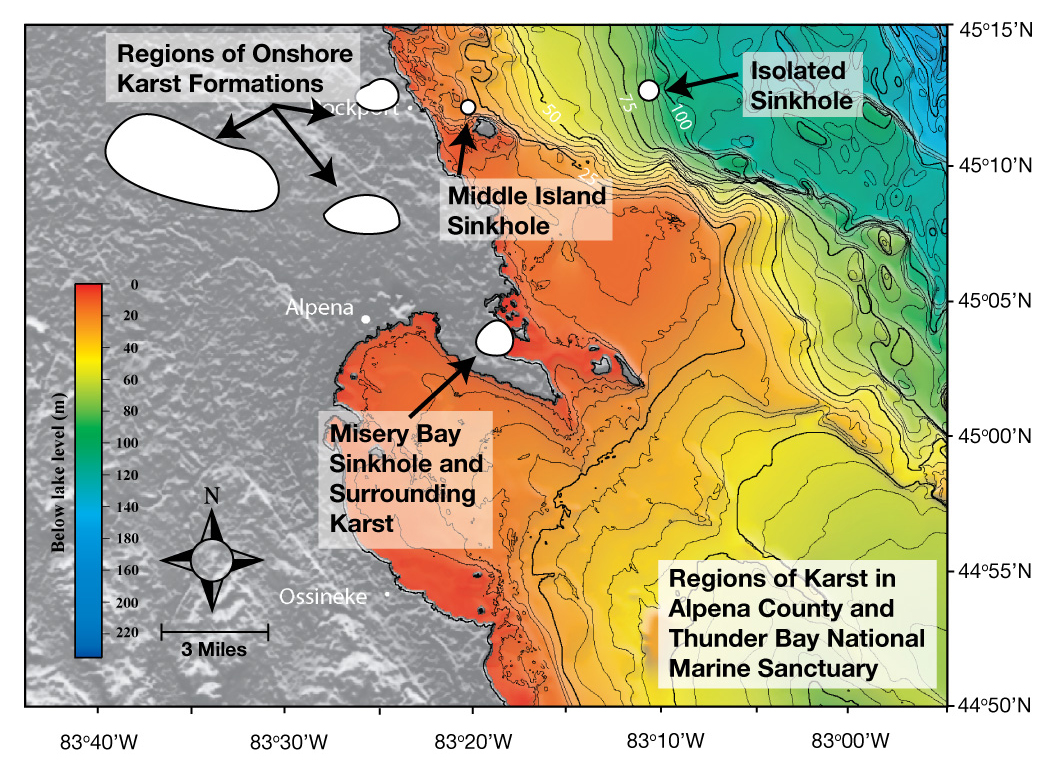
Figure 1: This map of the North American Laurentian Great Lakes Basin shows regions of karst (limestone) formations and above-ground limestone formations in Alpena County, Michigan. It also includes submerged sinkholes, including the study sites — Misery Bay, containing the El Cajon Bay Blue Hole, Middle Island Sinkhole, and Isolated Sinkhole — in the Thunder Bay National Marine Sanctuary, Lake Huron. Image courtesy of Thunder Bay Sinkholes 2008, NOAA, OceanExplorer.noaa.gov
Related Links
Thunder Bay Sinkholes 2008: Mission Plan
Download high-resolution image (Figure 1 Top jpg, 300 Kb)
Download high-resolution image (Figure 1 Bottom jpg, 824 Kb)