

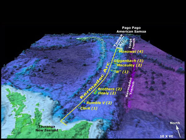
An overall image of the New Zealand American Submarine Ring of Fire 2005 expedition dive sites Yellow text indicates Pisces V dive sites Numbers in brackets following the volcano names represent the number of dives at each volcano The cruise track between Pago Pago and Tauranga covered over 2900 kilometers Bathymetry data sets for this image include low-resolution satellite altimetry data from Sandwell and Smith (bottom layer), and high-resolution EM300 bathymetry data in the area of the dive sites (top layer) The EM300 data are provided courtesy of New Zealand National Institute of Water and Atmospheric Research (NIWA) Bathymetry data are vertically exaggerated 10 times.
Related Links
New Zealand American Submarine Ring of Fire 2005
New Zealand American Submarine Ring of Fire 2005: Leg 2 Summary Log