

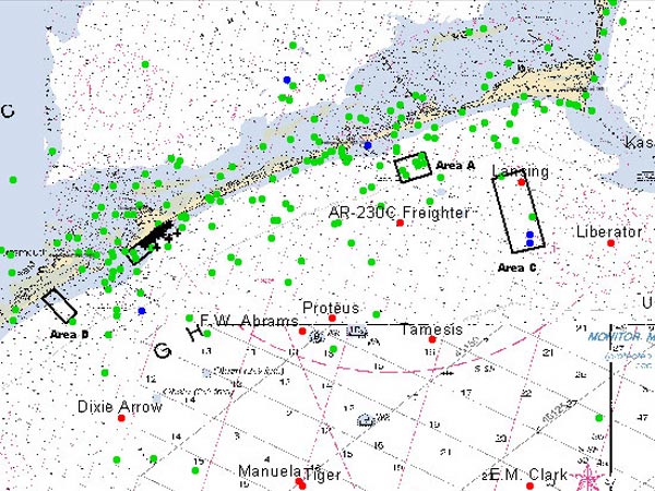
An extraordinary increase in the number of identified shipwreck sites since the beginning of the Ocracoke Shipwreck Survey has led to the development of a Geographic Information System (GIS), which can provide overlays of data by location, date, ship type, and other criteria. The GIS is then used to create survey blocks, like those in the image above, in areas identified as most likely to contain shipwrecks or vessel clusters. Image courtesy of Ocracoke 2004 Exploration, ECU, NOAA-OE
Related Links