back banner
back button
spacer
ocean explorer home pageNOAA home page

An elevation model of the Hudson Submarine Canyon.


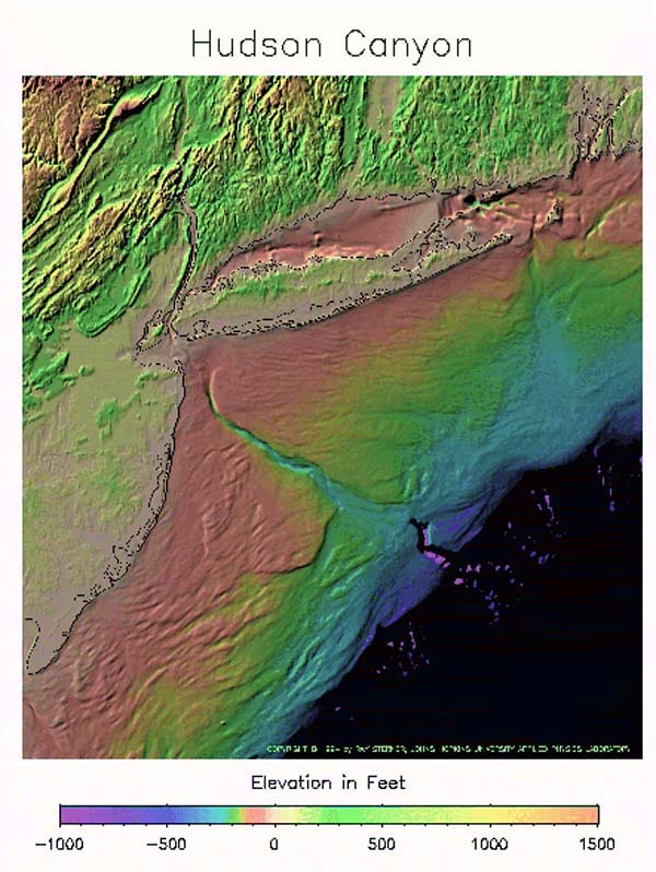
An elevation model of the Hudson Submarine Canyon, illustrating the range and depth to which the canyon extends. The Hudson Canyon is also the valley extending from the mouth of the Hudson River toward the southeast across the continental shelf. The shelf in this area is quite broad. The land north of the canyon is Long Island, and the water just north of it is Long Island Sound.


Related Links

Hudson Canyon Cruise

Hudson Canyon Cruise: Seafloor mapping


E-mail Updates | User Survey | Report Error On This Page | Site Index | Contact Us
Revised July 11, 2005 by the Ocean Explorer Webmaster
National Oceanic and Atmospheric Administration | U.S. Department of Commerce
NOAA Logo Commerce Logo
http://oceanexplorer.noaa.gov/explorations/02hudson/background/mapping/media/elevation.html