back banner
back button
spacer
ocean explorer home pageNOAA home page

Digital Terrain Model of Loihi Seamount


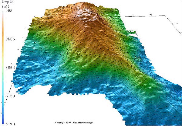
Digital Terrain Model (DTM) of Loihi Seamount generated from multibeam sonar data. Similar type of data will be acquired to map submerged banks and seamounts in the Northwestern Hawaiian Islands Coral Reef Ecosystem Reserve during the second leg of this expedition. (Source: Alex Malahoff).


Related Links

Northwestern Hawaiian Islands


E-mail Updates | User Survey | Report Error On This Page | Site Index | Contact Us
Revised July 11, 2005 by the Ocean Explorer Webmaster
National Oceanic and Atmospheric Administration | U.S. Department of Commerce
NOAA Logo Commerce Logo
http://oceanexplorer.noaa.gov/explorations/02hawaii/background/plan/media/loihi_seamount.html