

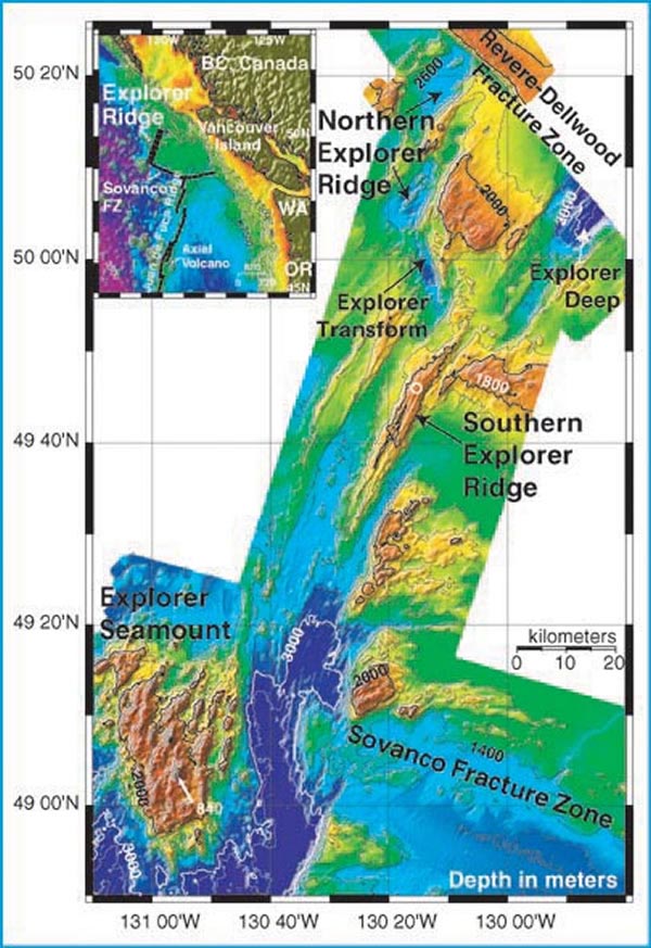
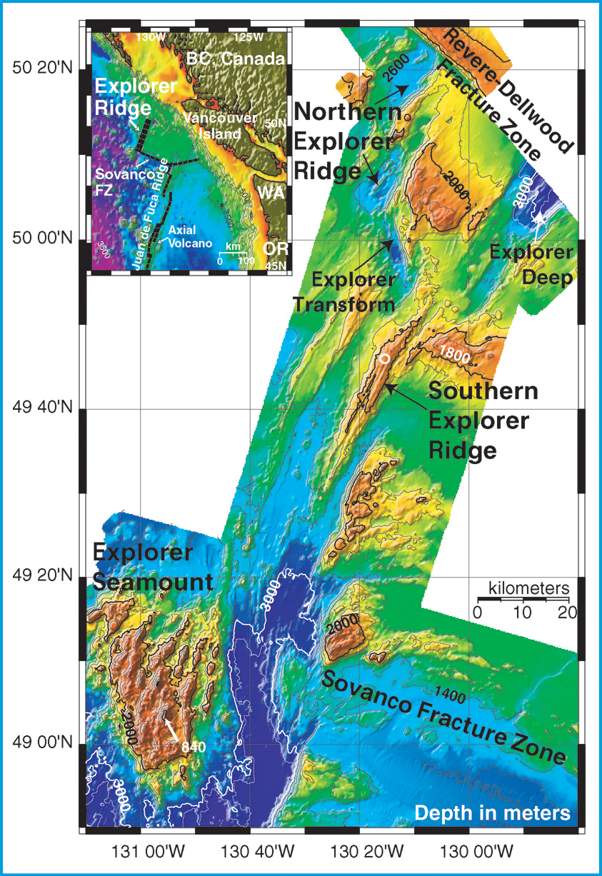
SeaBeam bathymetry of Explorer Ridge area, collected between 1980 and 1984. Bathymetry is contoured at a 200 meter interval. The inset shows the ridge location. The open white circle represents the approximate location of the Magic Mountain vent site. Image courtesy of Submarine Ring of Fire 2002, NOAA/OER.