

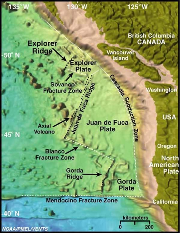
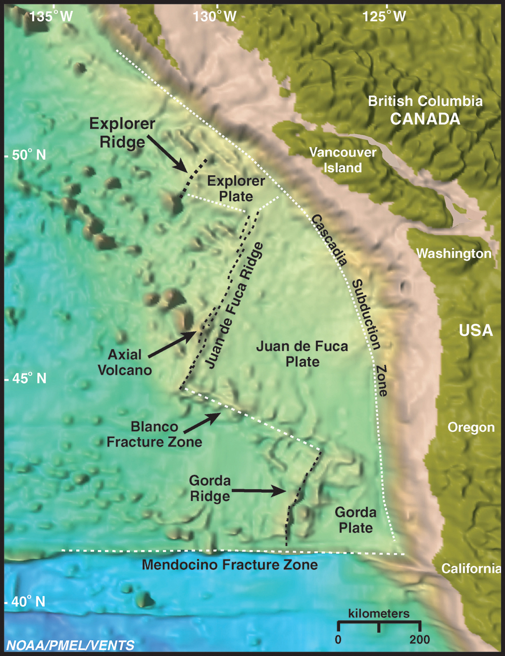
Satellite imagery of the northeast Pacific Ocean and western North Pacific Plate. Explorer, Juan de Fuca, and Gorda Ridges make up the plate boundary between the Pacific Plate and the Juan de Fuca/ Explorer/ Gorda Plates. The Cascadia Subduction Zone is also highlighted, which is the area where oceanic crust is subducting beneath the North American Plate. Image courtesy of Submarine Ring of Fire 2002, NOAA/OER.