Dr. Randy Keller: Video Transcript
Hear Randy Keller talk about his job, volcanic rocks, and some of the tools used to study underwater volcanoes. Download (mp4, 30.3 MB).
Introduction
My name is Randy Keller. I’m a geologist and an assistant professor at the College of Oceanic and Atmospheric Sciences at Oregon State University. I live in Corvallis, Oregon. Here in western Oregon, we have spectacular landscapes, beautiful geology. Like many geologists, I love the natural world, and I love coming out here and treating this as my natural laboratory.
In my job, I do a variety of things. It’s one of the things I really like about it. When I’m teaching, I spend a lot of time interacting with the students in the classroom. They often come by my office to talk about oceanography or geology. And I also quite a bit of work in the laboratory, trying to understand the chemical composition of the rocks I collect, and determine their ages.
I think what I enjoy most about working at sea is the scenery. The horizon is always there with beautiful could formations. You see a lot of marine life that you wouldn’t see on land. The other thing is working with interesting groups of people who do different things. When you work together as a team to solve problems, it develops a kind of camaraderie that you don’t get when you are in your office at home.
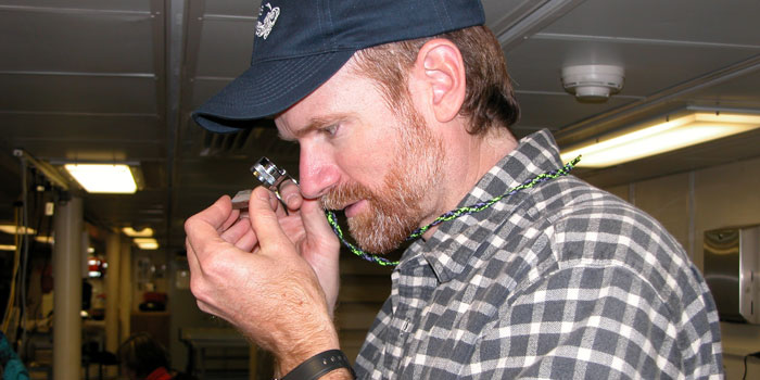
While at sea, it is up to Randy Keller to decide where to take the ship to make bathymetric maps of the sea floor.
Responsibilities at Sea
My responsibilities while at sea are to decide where we want to map, where we should take the ship to make our bathymetric maps of the sea floor. That allows us to pick locations where we can dive with the Alvin to look for good rock samples. And once we’ve collected the rock samples, we catalog them, and describe them at sea, and then pack them up and get ready to take them home.
This clip shows us picking the samples out of the basket in the front of Alvin. This is where Alvin places the samples. After it has picked up a rock from the seafloor with its manipulator arm, it puts the rocks into the basket. And once we have the submarine back on deck, we can pick those rocks back out.
Like on many expeditions, graduate students come along to help with the duties at sea and also to learn what its like to be a geologist at sea. They bring their knowledge and we work together trading ideas and working on the samples. There is a lot of teamwork involved in preparing and describing the samples after we get them on the ship, and this clip shows some of the graduate students that I brought along, helping me describe the samples and prepare them for bringing them back to the laboratory.
In this clip, I’m getting my first look at a rock that we’ve just brought on board. We’ve cut it open, and I’m using a hand lens, a magnifying glass, to get a close-up look at the texture and the minerals inside the rock to tell me how it formed. The next step up from a magnifying glass is a microscope. What a biologist would use for dissecting, geologists use them to get a higher power magnification view of the rock and actually see the smallest detail. It shows us how the lava flowed and how big the minerals are, and how long they had to grow. Along with the hand lens, the other favorite tool of the geologist is called a rock hammer. It’s useful for breaking up the rocks and getting a fresh surface inside the rock for us to look at.
The biggest challenges at sea have to do with adjusting to life on a ship. Also, I’m fairly tall. I’m 6’5”. And ships have small confined spaces. The beds are smaller, the doorways are lower, and I have to watch my head a lot on ships.
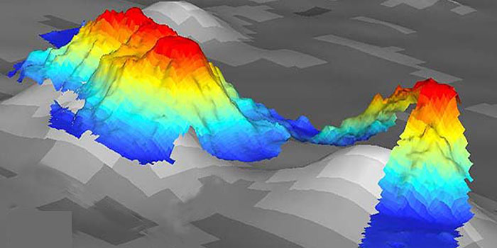
Dr. Keller talks about conducting research to learn about the formation of a chain of seamounts in the Gulf of Alaska.
Mission Goals
This expedition was for the purpose of learning how the chain of seamounts that we were studying formed. They are volcanic, and the eruptions occurred on the sea floor. In the long term, we would like to know sort of the bigger picture of how seamounts in general tend to form, especially those in the Gulf of Alaska. All over the ocean floor, there are thousands and thousands of seamounts that we could never hope to visit them all. But understanding fundamentally how they form and why will tell us a lot about why the ocean floor looks the way it does.
One of the most exciting things we found on this mission was some of the beautiful volcanic landforms that we saw on the maps that we were creating. For the first time, we had these high resolution maps of the seamounts, and we saw some amazing lava flow features that are still preserved even though they are millions of years old that look just like the ones you see forming today on Hawaii.
This is an example of the types of rocks that we look for to determine the age of a seamount. Here is a volcanic rock taken from a volcano. To determine how old it is, we need to bring it into the lab, and either take a small core of it, like this, using a drill, or in some cases, we’ll crush the rock into small grains. Or maybe even remove the minerals from it and make a separate concentration of certain types of minerals, and use those as our samples to put through the dating machine and determine how old the volcano is.
Another interesting thing that I notice on expeditions like this one to the Gulf of Alaska, was how important the rocks are to the biology that live down there. Many types of biology only like to live in rocky areas. They don’t like muddy parts of the seafloor, so they look for rocks to attach themselves to, so that they can find food in the passing ocean currents.
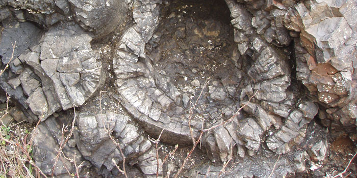
Dr. Keller talks about "pillow basalts"—rocks whose unique radial fracture pattern was seen on the seamounts in the Gulf of Alaska.
Volcanic Rock Formations
Here on Mary’s Peak, in the Oregon Coast Range, we find pillow basalts, like the one next to me here. This one is broken open, so you can see the inside of it, the unique radial fracture pattern that we were able to see very distinctly on the seamounts in the Gulf of Alaska. And this whole hillside is built out of these pillow basalts. And if you look up above here, you can actually see one that has not been broken up. It has that very round, blobby appearance to it that shows you why we call these “Pillows.” And that’s how they originally look on the sea floor. Then they break up, and we can see the inside, and this unusual fracture pattern. This only occurs underwater, and we saw that a lot on the Gulf of Alaska seamounts, and now we can see it on the side of this mountain here, and that tells us that Mary’s Peak used to be a seamount, and was originally formed underwater, and at some point after that, was thrust up onto land and now it is part of the Oregon coastline.
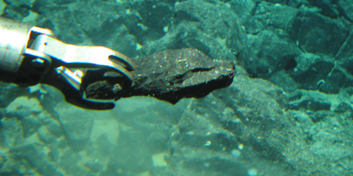
Learn how the Alvin submersible allowed Dr. Keller and his colleagues to study the seafloor.
Deep Submersible Technologies
When we’re studying the seafloor, we have a choice of different types of deep submergence technology. On this expedition, we used Alvin to study the seafloor, and that has the advantage of, more or less being independent from the ship. On expeditions where you’re going somewhere new like this one, you’re exploring new territory, you don’t know what you will see. You don’t know what you’ll find. And you might have a change of plans once you get to the bottom. You thought you were going to go right, and it looks better to go left. Alvin can do that. You can, at any moment, tell the pilot you want to stop, turn around, go somewhere else, go faster, go slower. Another option is a remote operated vehicle where you are still on the ship, and you are looking at a computer screens, video screens. And down below you, on the seafloor, there is a remotely operated sub that is unmanned, but you can control its cameras and its sampling arms, and things like that.
Not very many people get a chance to dive in Alvin, but the few that do, get a special initiation ceremony when they come back after their first dive. The traditional initiation is to have ice water dumped on your head. But some people get even more special treatment beyond that.
If you’ve ever been down to the bottom of a swimming pool, you notice the pressure on the inside of your ears. This is from the water. Now, in the Gulf of Alaska, in Alvin, we were down about 3000 meters. And what that pressure could do to you, if you were not protected by the submarine, is illustrated by what I am holding in my hand here. This is a Styrofoam wig head, for displaying hats and wigs. And it’s traditional for us to paint and decorate these Styrofoam heads like this, and then attach them to the outside of the Alvin submarine, where it is exposed to the outside pressure of going down to the bottom of the ocean. The larger head gets crushed down to this smaller, tiny size here.
Here is another example of what water pressure can do. This small foam cup used to be the size of a normal coffee cup. When we put it on the outside of the submarine and sent it to the bottom of the ocean, it was crushed down to this much smaller size.
"Geologists love to try to understand how the Earth formed."
Words of Advice
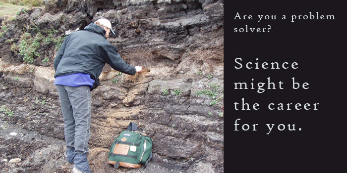
Whether its on the sea floor in the Gulf of Alaska, or here on the side of Mary’s Peak, Geologists love to try to understand how the earth formed. Why we have mountains, why we have earthquakes, just putting the pieces of the puzzle together in understanding the natural world.
I hope you’ve learned a little bit about marine geology, and if you love solving problems and making new discoveries, then a career in science could be for you.
Return to profile