

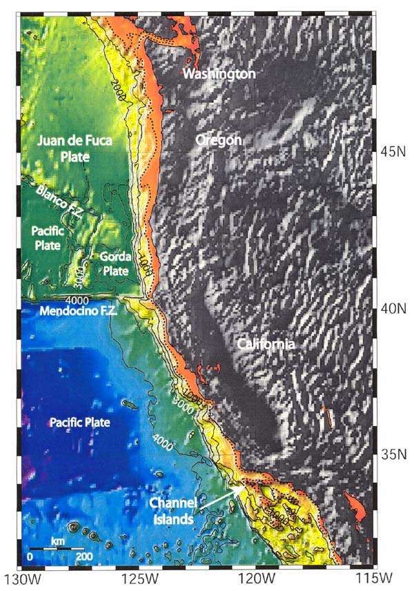
Bathymetric map of U.S. West Coast showing the dramatic tectonic features created by the movement of the Juan de Fuca, Gorda and Pacific Plates. The dashed line shows the 140 meter contour, and indicates the approximate location of the ancient shoreline during the last glacial period (15 - 20,000 years before present). Image courtesy of Lewis And Clark Legacy Expedition, NOAA-OER.