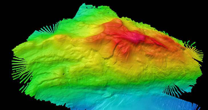
Image courtesy of NOAA Ocean Exploration, Océano Profundo 2018: Exploring Deep-sea Habitats off Puerto Rico & the U.S. Virgin Islands. Download largest version (jpg, 169 KB).
The mapping of Mona Seamount, which rises about 7,700 meters (4.78 miles) from the Puerto Rico Trench, was a highlight for the expedition’s mapping team during Océano Profundo 2018.
