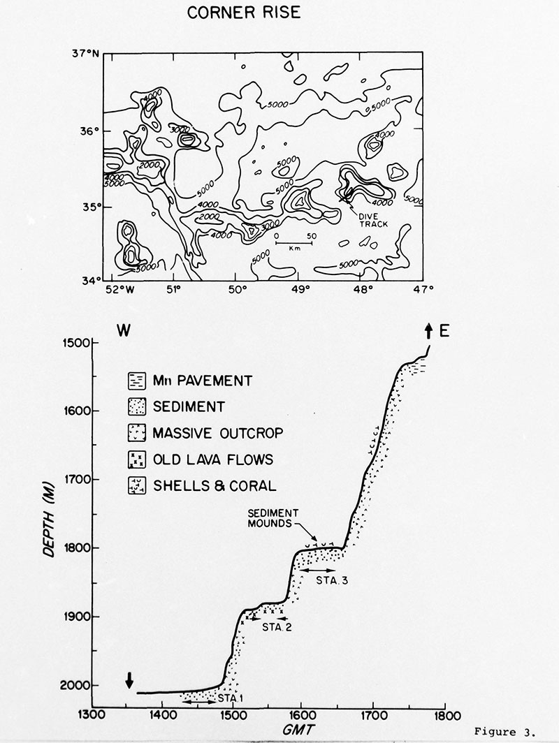
During the summer of 1974, scientists from the Woods Hole Oceanographic Institution conducted a dive using human occupied vehicle Alvin on one of the Corner Rise Seamounts. The top graphic shows the location of the dive track, with contours in meters and a 50-kilometer distance measure shown. The bottom graphic displays information about topography and rocks and sediments observed on the seafloor, shown as depth versus time. Despite the fact that the dive took place decades ago, collected data remains the most recent available.
Dive on One of the Corner Rise Seamounts
Image courtesy of Woods Hole Oceanographic Institution. Download largest version (jpg, 1 MB).

During the summer of 1974, scientists from the Woods Hole Oceanographic Institution conducted a dive using human occupied vehicle Alvin on one of the Corner Rise Seamounts. The top graphic shows the location of the dive track, with contours in meters and a 50-kilometer distance measure shown. The bottom graphic displays information about topography and rocks and sediments observed on the seafloor, shown as depth versus time. Despite the fact that the dive took place decades ago, collected data remains the most recent available.

Learn more