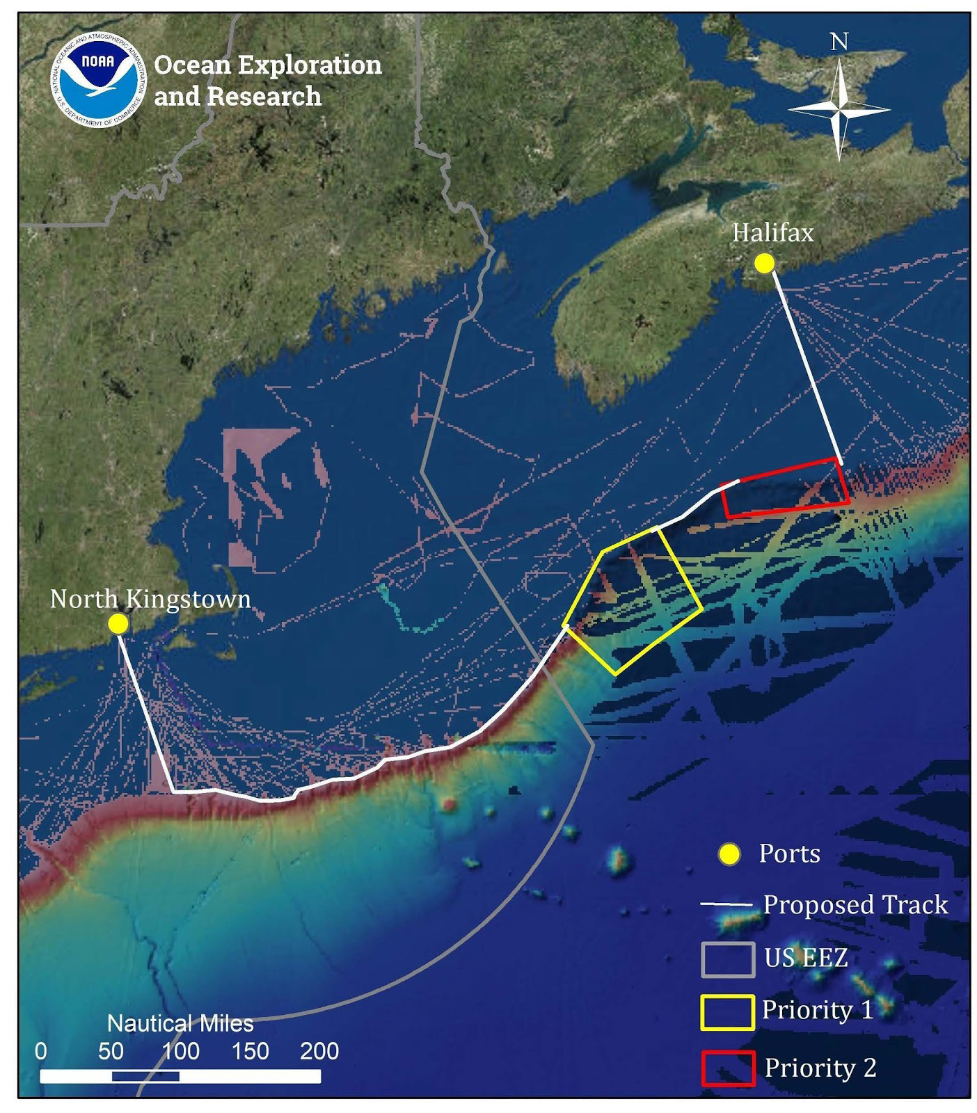
Map showing the priority areas for and mapping operations to be conducted during the Deep Connections 2019 expedition, overlaid onto existing mapping data in the region. This expedition will explore poorly understood deepwater areas of the U.S. and Canadian Atlantic Continental Margin to address science and management priorities of the region.
Leg 1 Map
Image courtesy of the NOAA Office of Ocean Exploration and Research. Download larger version (jpg, 1.2 MB).
Map showing the priority areas for and mapping operations to be conducted during Leg 1 of the Deep Connections 2019 expedition, overlaid onto existing mapping data in the region. This expedition will explore poorly understood deepwater areas of the U.S. and Canadian Atlantic Continental Margin to address science and management priorities of the region.
Learn more