
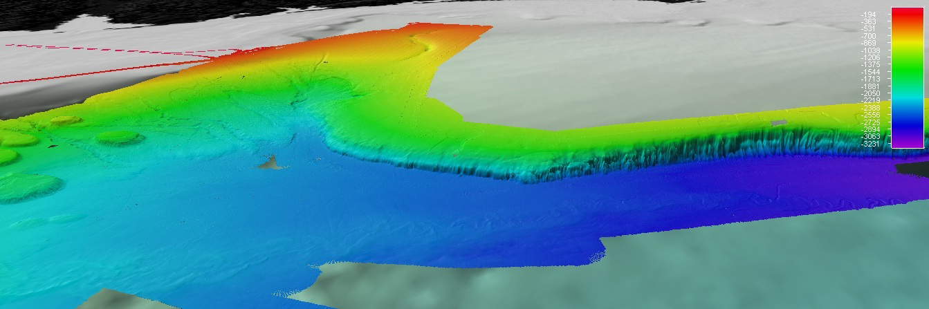
A Fledermaus screenshot showing overview of multibeam coverage surrounding leveed meandering channel. Dashed yellow oval highlighting extent of meandering channel as of 7 April 2012. The West Florida Escarpment is clearly shown in background EM 302 multibeam data. Additional background data shown courtesy of Sandwell and Smith. Color scale bar showing depth in meters.