This "before and after" image provides a glimpse of <em>Okeanos Explorer</em>’s EM302 mapping system capabilities in deep water. The top image shows what we previously knew about the seafloor terrain in the southern Mariana region from satellite altimetry data. The bottom image includes an overlay of the information provided by the ship's EM302 multibeam system. <em>Okeanos Explorer</em> will focus on mapping waters deeper than 2,000 meters during the expedition, while <em>Baruna Jaya</em> IV will collect multibeam data down to 2,000 meters – the maximum rating of its multibeam system.
Seafloor Maps
Image courtesy of the NOAA Office of Ocean Exploration and Research, INDEX-SATAL 2010. Download larger version (jpg, 867 KB).
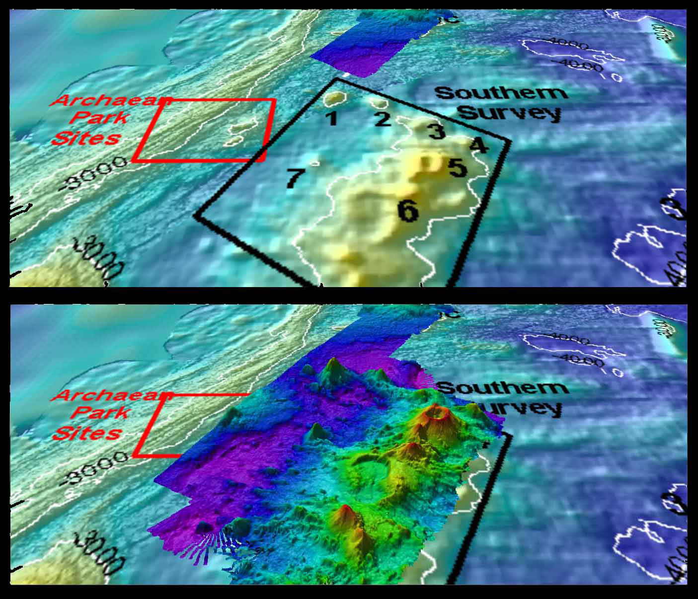
This "before and after" image provides a glimpse of Okeanos Explorer’s EM302 mapping system capabilities in deep water. The top image shows what we previously knew about the seafloor terrain in the southern Mariana region from satellite altimetry data. The bottom image includes an overlay of the information provided by the ship's EM302 multibeam system. Okeanos Explorer will focus on mapping waters deeper than 2,000 meters during the expedition, while Baruna Jaya IV will collect multibeam data down to 2,000 meters – the maximum rating of its multibeam system.
Learn more