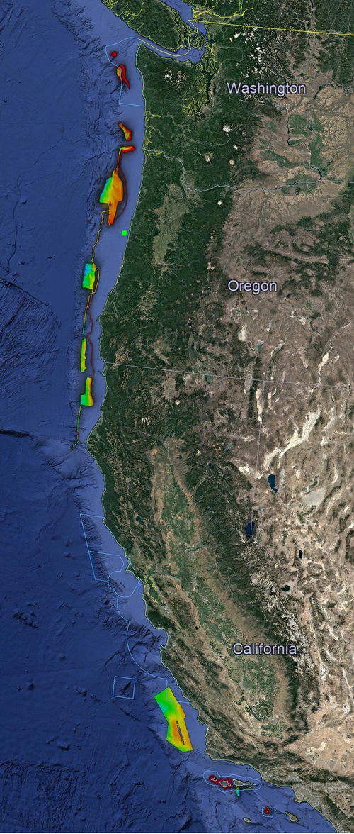
EXPRESS 2018 Overview: Google Earth image of the west coast of the United States. Image shows the outline of the five west coast National Marine Sanctuaries and a compilation of the multibeam data collected as part of EXPRESS in 2017 and 2018. These data are informing 2019 Lasker expedition plans.
 Schematic
Image courtesy of Google Earth. Download larger version (jpg, 143 KB).

EXPRESS 2018 Overview: Google Earth image of the west coast of the United States. Image shows the outline of the five west coast National Marine Sanctuaries and a compilation of the multibeam data collected as part of EXPRESS in 2017 and 2018. These data are informing 2019 Lasker expedition plans.

Learn more