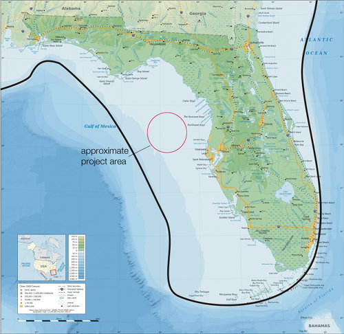
A modern map of Florida shows (with a dark line) the approximate location of the Last Glacial Maximum (LGM) coastline. During the Late Pleistocene, Florida's shoreline extended much farther offshore than the present coast. The general project area is indicated.
Project Area
Image courtesy of Exploring the Submerged New World 2009 Expedition, NOAA-OER. download larger version (jpg, 3.7 MB).

A modern map of Florida shows (with a dark line) the approximate location of the Last Glacial Maximum (LGM) coastline. During the Late Pleistocene, Florida's shoreline extended much farther offshore than the present coast. The general project area is indicated.

Learn more