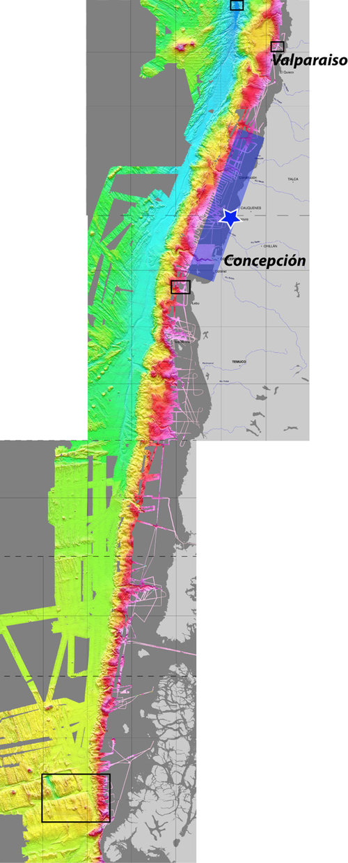
Figure 1. This Chile margin map shows seafloor depths from 600 to 6,000 meters (1968 to 19,685 feet) in color (pink to purple), our study areas (black boxes), the recent earthquake epicenter (star), and the approximate area of the fault that slipped during the earthquake (blue box). The steep slope where landslides occur is indicated by the rapid color change (from red to yellow).
Chile Margin Map
Image courtesy of INSPIRE: Chile Margin 2010. Download image (jpg, 139 KB).

Figure 1. This Chile margin map shows seafloor depths from 600 to 6,000 meters (1968 to 19,685 feet) in color (pink to purple), our study areas (black boxes), the recent earthquake epicenter (star), and the approximate area of the fault that slipped during the earthquake (blue box). The steep slope where landslides occur is indicated by the rapid color change (from red to yellow).

Learn more