

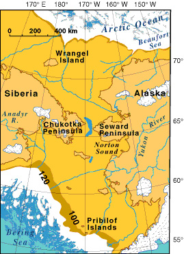
Map of the Bering land bridge during the late Wisconsin glaciation, when global sea level dropped to about 120 meters (393 feet) or more below its present position. Image courtesy of Exploring the Submerged New World 2009 Expedition, United States Geological Survey, NOAA-OER.
Related LinksExploring the Submerged New World 2009
Exploring the Submerged New World 2009: Early Human Occupation