

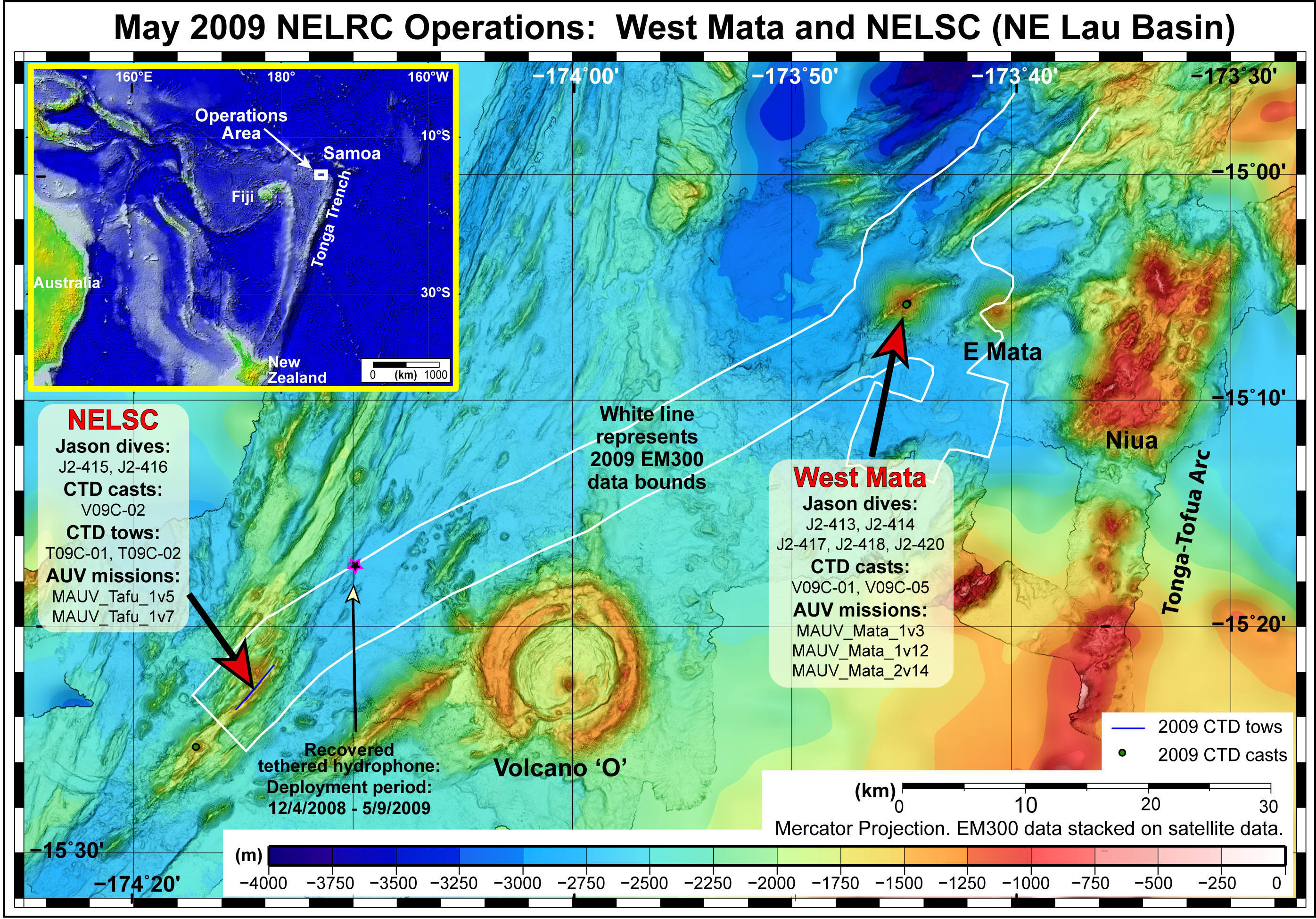
This map identifies the cruise operations accomplished during the Northeast Lau Response Cruise in May 2009. While in the same general area as the cruise in November 2008, the 2009 cruise focused more on the eruptive sites at West Mata and the Northeast Lau spreading center. The inset (upper left) puts the operations area in geographic context. Map courtesy of NOAA.