

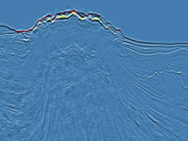
Three-dimensional seismic data were used to examine the sea floor. These data, created for the oil and gas industry to prospect for hydrocarbon in deep reservoirs, is acquired by sending sound waves from a ship down to the sea floor and deeper; these sound waves bounce off different layers below the Earth’s surface and back to long cables with sensors pulled behind the ship. Massive computers process the data and create pictures of the sea floor and the inside of the Earth. This vertical seismic profile shows the shallow part of the Earth below the site investigated. Note the irregular surface of the sea floor on top of the bathymetric high. The depressions are circular “pockmarks” we interpret to be caused by forceful expulsion of natural gas that excavated the sediment and ejected it to the surrounding sea floor. Seismic data courtesy of CGGVeritas, Inc.