

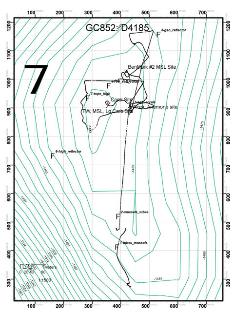
This map shows the deep submergence vehicle (DSV) Alvin dive track along the sea floor. The dive starts at the bottom of the image and heads north towards the top. You can see how the DSV Alvin circled the mound early. Researchers later discovered corals on that mound. The black line ends on top of the coral mound when the Alvin left the sea floor and started the ascent back to the surface. Image courtesy of Expedition to the Deep Slope.