

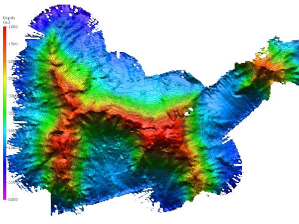
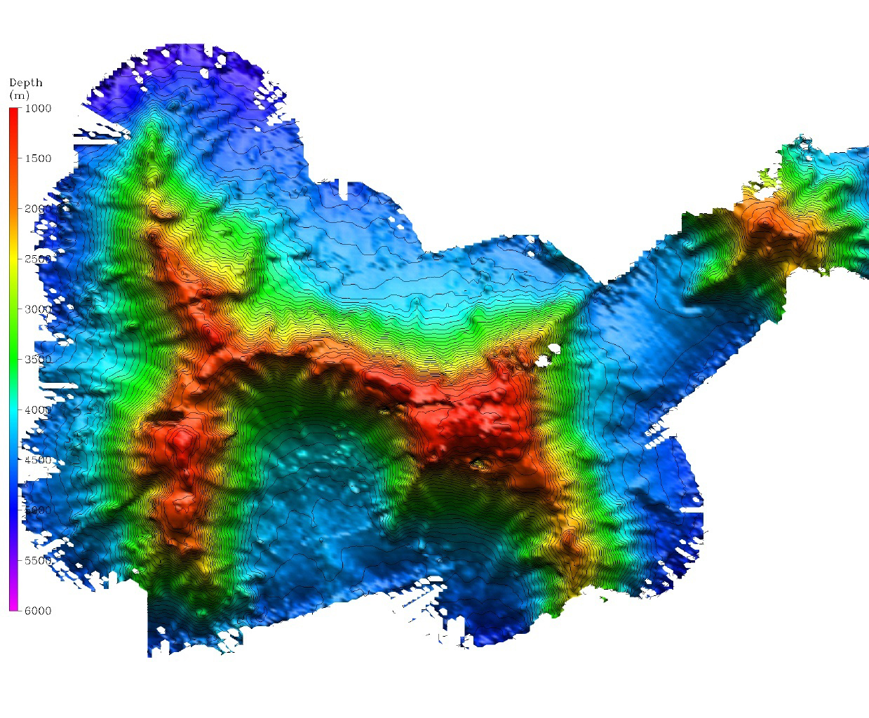
Bathymetry of the Lyman Seamount, shaded relief map. The image above shows the entire East Corner Rise seamount complex, tentatively named Lyman Seamount. The resolution of the image is approximately 40 m. The map was created with data from 25 hours of surveying over three days. Image courtesy of Allen Gontz of the University of Massachusetts and Jonathan Shanahoff of NOAA.
Related Links
North Atlantic Stepping Stones 2005