


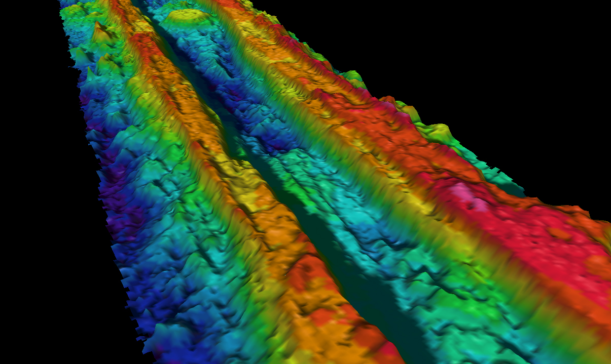
This bathymetric map created using the EM-300 multibeam sonar shows the ridge crest at 4 times greater resolution than previous maps. Seeing the ridge in greater detail enhances our ability to interpret the geological processes that contribute to shaping the ridge. Image courtesy of UCSB, Univ. S. Carolina, NOAA, WHOI.
Related Links
GalAPAGoS: Where Ridge Meets Hotspot
GalAPAGoS: Where Ridge Meets Hotspot - Dec 5 Log
Download high-resolution image (jpg, 604 Kb)