

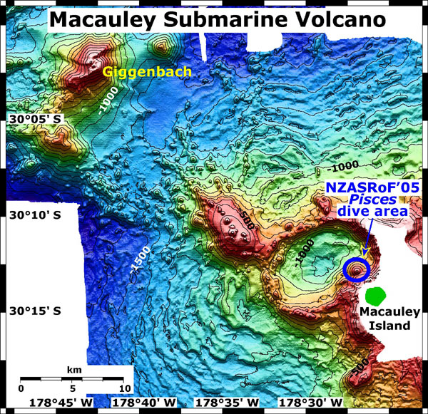
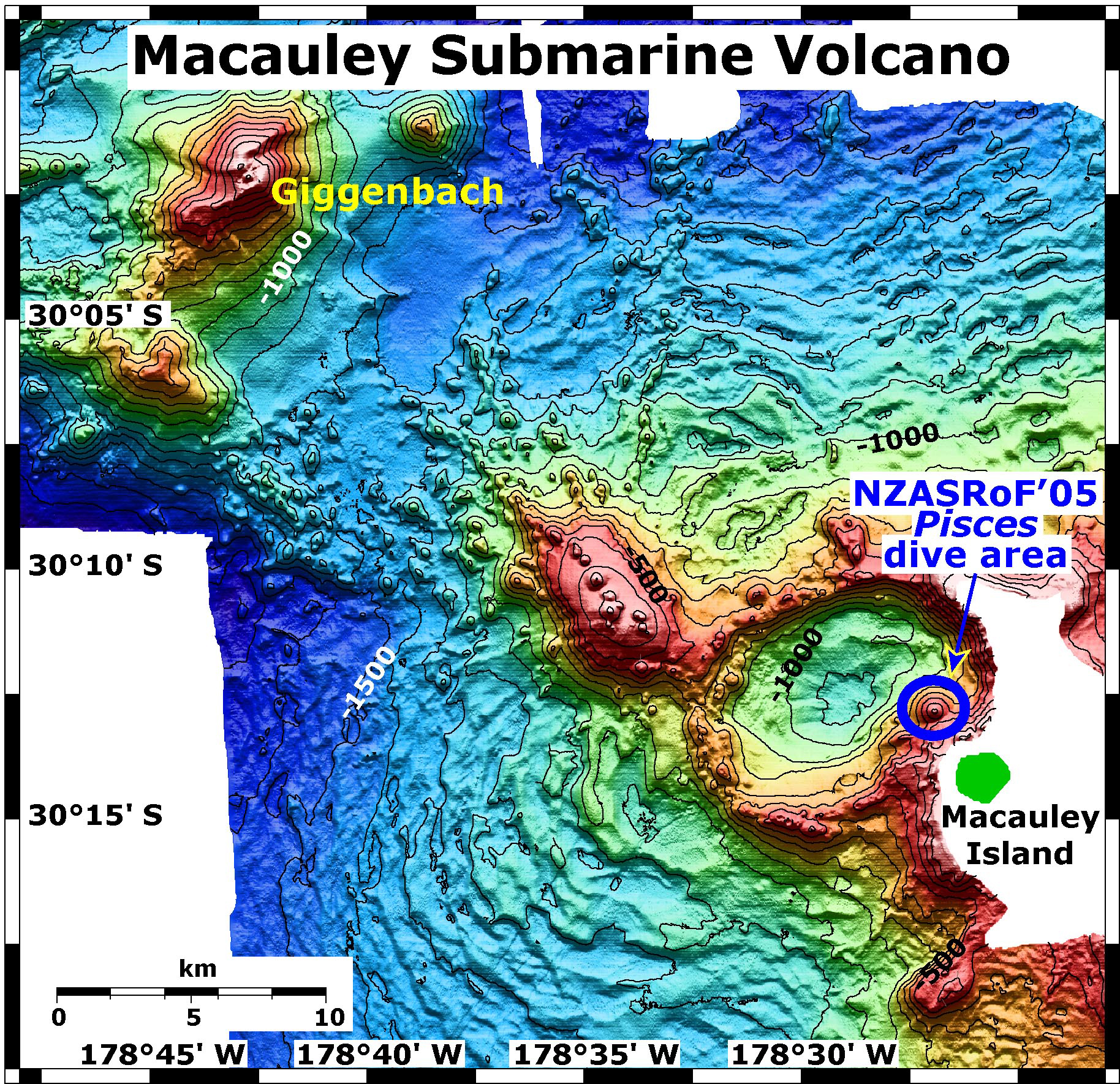
Map view of Macauley and Giggenbach submarine volcanoes. NZASRoF'05 submersible dive site and Macauley Island are indicated. Giggenbach is in the NW corner of the map. The Pisces dive area is on the eastern rim of Macauley caldera. The map contour interval is 100 meters. The resolution of the bathymetry data is 25 meters. The bathymetry data are proprietary and provided courtesy of Ian Wright, New Zealand National Institute of Water and Atmospheric Research (NIWA).
Related Links
New Zealand American Submarine Ring of Fire 2005
New Zealand American Submarine Ring of Fire 2005: April 15 Log