

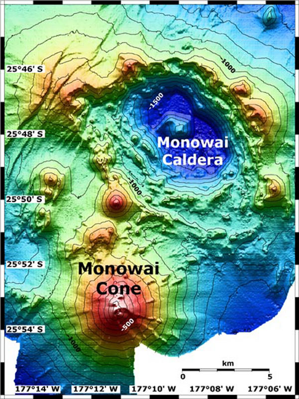
Map view of Monowai submarine volcano, featuring the cone in the south-southwest and the caldera to the northeast. The contour interval is 100 meters. The resolution of the bathymetry data is 25 meters. The bathymetry data are proprietary and provided courtesy of Ian Wright, New Zealand National Institute of Water and Atmospheric Research (NIWA).
Related Links
New Zealand American Submarine Ring of Fire 2005
New Zealand American Submarine Ring of Fire 2005: April 5 Log