

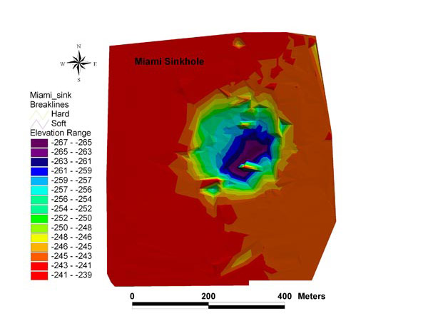
Figure 2: A bird's eye view of Miami Sinkhole, produced from fathometer soundings conducted prior to deployment of the submersible. This map was produced from 950 individual data points and gaps between these points were filled in, or interpreted, with GIS software. Image courtesy of Doug Weaver.
Related Links
Florida Coast Deep Corals 2005
Florida Coast Deep Corals - Nov 16 Log