

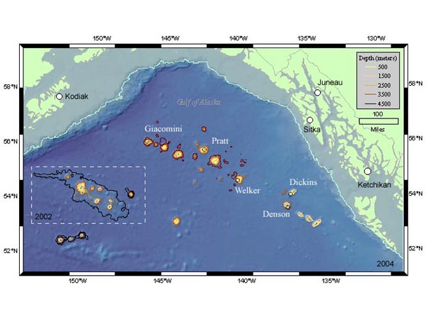
This map of the Gulf of Alaska shows the seamounts that will be explored during this expedition. The area within the box is the region that was studied during the 2002 cruise. Areas seaward of the continental shelf contour line are deeper than 1,000 m (~.5 mile). Areas outside the contour line within the box are deeper than 4,000 m (~ 2.5 miles). Black circles indicate seamounts rising up from these incredible depths to within 200 m of the surface. Image courtesy of Peter Etnoyer.
Related Links