

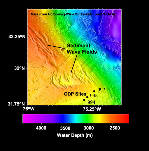
This bathymetry map reveals two sediment wave fields on the Blake Ridge. The southernmost wave field was previously believed to represent a large-scale collapse of the seafloor, but the work of Dr. Holbrook, Ph.D. student Matt Hornbach, and their colleagues, has demonstrated that the area of disturbed seafloor is a normal sedimentary feature overlying a region with complicated gas flow patterns. Some of the data that make up this bathymetric map were collected on the NOAA-sponsored Deep East 3 Cruise to this area in 2001 (link to Deep East). The locations marked as ODP (Ocean Drilling Program) sites were drilled to depths of greater than 750 meters below the seafloor during a 2-month cruise aboard the JOIDES Resolution drillship in 1995. Image courtesy of C. Ruppel.
Related Links
Windows to the Deep Exploration