

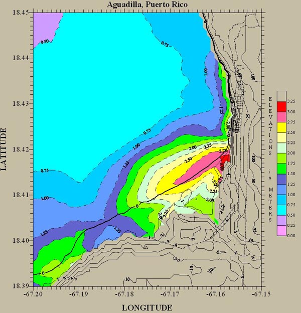
Figure 4. Numerical simulation of the 1918 Puerto Rico tsunami showing calculated inundation of the Aguadilla coast in northwest Puerto Rico. Heavy black line = coast line; thin lines = topographic contours. Image courtesy of USGS ![]() .
.
Related Links
Puerto Rico Trench Exploration