

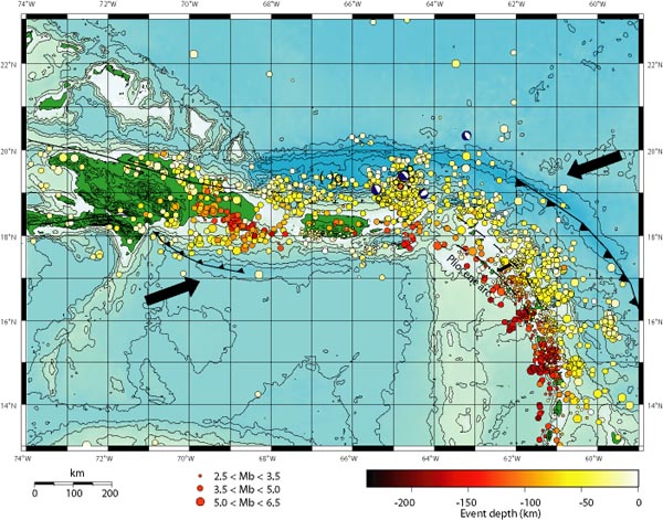
Figure 2. Location of earthquakes as a function of depth and size in the northeastern Caribbean. Barbed lines represent subduction zones; arrows represent the direction of relative plate motion; dashed lines represent migration of the line of volcanoes from an older line to a newer one farther west; and (-)g represents the location of the largest minimum gravity anomaly on Earth.
Related Links
Puerto Rico Trench Exploration