

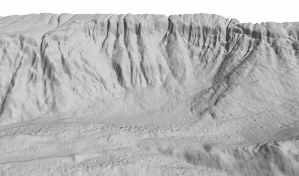
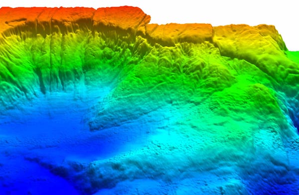
Figures 2a and 2b. Two views of the same slide imaged by the multibeam bathymetry method. These figures were generated by combining seven along-slope bathymetry swaths that were collected during a day and a half of surveying and processed in near real-time. The gray scale image was rotated to mimic the viewing angle and lighting direction in Figure 1. A more regional 3-D view, with colors representing depth, shows the scarp from a different angle. The resolution of these images is 150 meters, much higher than in Figure 1.