

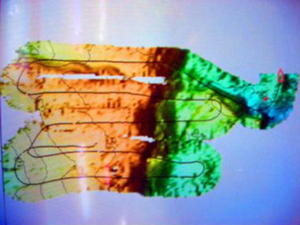
Seabeam image of bathymetry at Diaphus Bank. The areas surveyed covered the actual ROV tracks during dive 42. This bathymetric data will be used to create the first ever high resolution map of the area. Image courtesy of D. Weaver, FGBNMS.
Related Links
Gulf of Mexico Deep Sea Habitats 2003