

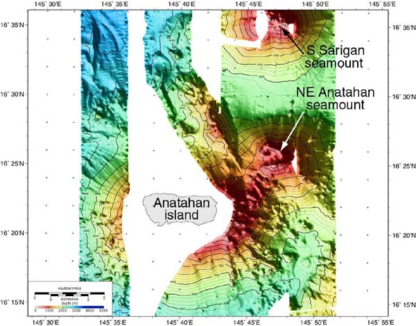
Map of EM300 multibeam sonar bathymetry around Anatahan island, collected during the 2003 Ring of Fire expedition. No hydrothermal activity was found in February 2003 at the neighboring submarine volcanoes, NE Anatahan and S. Sarigan. Map by Paul Johnson, Hawaii Mapping Research Group.
Related Links
Submarine Ring of Fire 2003: Anatahan Log